Right where do I start. Try and remember the wordpress logon and password would be a good way to progress.
Back in the hills, and glad to be there. It’s been an awful long time since I managed to get myself up a SOTA hill, not that I’ve been sitting on my hands, just not doing any stuff of note. I had been up a wee hill behind Dunoon recently, but not big enough to qualify for SOTA status, but a nice wander anyway. Managed to chase Robin PKT from there, so the day was not wasted. Being busy with this or that, I had not managed to get up any summits, but had planned a joint/separate activation with Bobby GAX, which had to be cancelled unfortunately. So, what is a joint/separate activation you ask, well we had planned on traveling together to a certain location, then split up and do separate hills.
As the year tramped on, few occasions occurred when we could both manage an outing together, but with International SOTA weekend looming, what better time for my first SOTA activation of 2012? The joint/separate activation of Beinn a’Mhanaich and Beinn Chaorach was on. Bob was to to a’Mhanaich as he is quite fond of it, and it is one of his ‘”boomerang” hills which he keeps going back to – 4 times now. I was to tackle Chaorach as I’d never done it before, so it would be another unique for me.
International SOTA Weekend was to be 05/06 May 2012, so on the Thursday evening we decided it was a go-er. The WX was to be fine to start, with a bit of high level cloud to come in later, but only 4mph winds – ideal WX for heading out. Saturday Dawned bright and cloudless as promised by the Met’ office. I was up with the lark, or the dogs at least and found myself surprisingly on time for a change. My Highlander 33 having been packed the previous evening after an overtime shift at work, it was a simple matter of jumping in the Landy, stopping at Tesco for a chit and crisps then off to pick up Bobby at his chosen spot. Only 3 minutes later than planned, he had hoisted himself aboard the SOTA waggon and we were off.
The usual route of M8, Erskine bridge, A82 and then onto the ex MOD road (A817) saw us heading up Glen Fruin with a bit of high cloud rolling in above. We sussed out a parking spot for the Landy then I dropped GAX at the foot of his chosen hill. The red flags were flying on the Strone indicating that the firing range was in use. A load of Police vans – probably MODPLOD – were parked up at the range, and the sound of firing could indeed be heard. To my untrained ear it sounded rather large calibre rounds that were being used, not just the usual crack of a smaller cartridge, more a booming thud type noise. Anyway, the bullets have been trained to fall from the sky where they meet the line of warning notices and red flags on the Strone, so as long as Bob stayed to the right hand side, he would live to activate another summit. We made arrangements to be in contact via PMR radio frex and I left to head back to Chaorach. Once at my parking spot of which there are plenty – good solid verge that keeps the whole car off the road and behind the  solid white line at the side of the road just at BALLYVOULIN farm – I got my pack on, picked up my radios and soon I was off having started the Endomondo tracker on my phone. For those with a smart phone, this free app’ ( paid for version is only slightly better ) is invaluable. It tracks your progress, mileage, speed, average speed, split times which can be miles or Kms and even talks to you after each mile to tell you your lap time! Even more, your XYL, or indeed anyone who cares, can track your progress more or less real time with about 1 minute delay. They just go to the Endomondo site and find you. I would imagine it being very handy in a rescue situation if the authorities can pinpoint your location quickly – or at least the location of your phone – and I’m sure there will be stories out there of this having been done.
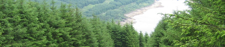
Anyway, back to the hill. You enter a sheep field ( Beinn Chaorach means hill of the sheep ) at roughly 295-888 on OS Explorer map 347 and basically head straight up. Your objective is a gate at the top left hand corner of this field beside the small wooded area on your left. By the time you reach this gate, you will notice that you are following a quad track, and the rest of the walk pretty much follows this track. Your first objective is to reach the top of Auchengaich Hill which is the end of the steepest part of the walk and the worst is now behind you now. A gentle stroll down a bealach and up onto Beinn Tharsuinn marked by a cairn. I chose this as a resting point and to have a look about using my laest toy – a 10×50 Barr&Stroud Sprite monocular. This inexpensive ( £40 odd ) spy glass is waterproof and nitrogen purged to stop it from fogging, so is ideal for up the hill. It comes with a tabletop tripod, but can also be mounted on anything with a standard tripod mount – like my Leki stick which has the mount hidden inside the handle. The Sprite is rubber armoured for ruggedness, and was a joy to have with me. Obviously a decent pair of binoculars to the same spec’ would be better, but are also twice the price, and twice the size and weight of the monocular. I spent nearly 20 minutes looking back at my home town, looking down the river to Ailsa Craig and up towards Paisley and beyond. It had been noticed by Bob and myself that there were the odd snow flakes falling, and we chatted on the PMR discussing this and our progress. I had also contacted jack GM4COX on 2m on his summit of the day and he commented that there was the odd flake there too. Indeed, on closer inspection I noticed that there was still some ice on a couple of minor puddles on the hillside.
Despite the coldish temp’s. the ground was not firm, and the odd soft / wet patch showed itself where there was water sitting about on mossy areas. With a slight bit of forward thinking, these areas were easily avoided and your feet can stay dry on your way to the top. At one point, the mushy underfoot conditions were ‘jooked’ by merely stepping over the low fence away from the quad track and following the way up on the untouched and uncut ground.
The final push to the top is short and enjoyable and sees you on a largish flattish top with a fence running over roughly North / South.. The trig point is on the East side of the fence which is easily stepped over to reach your goal. Endomondo showed my distance to be 2.69 miles in 1 hr 50 mins. Bobby had already summited his chosen hill and was on 4m by the time I got to the top. We had a quick STS on PMR, which may be a first (?) before I got my 3 ele SOTA beam set up and attached the mounting pole to one of the fence posts. My operating position was lying on the grass beside the trig point which was very pleasant  when the sun was shining. Once on 2m, my first contact was to Bobby GAX and my first of 3 STS’s of the day were in the bag. I was using the new ‘Q’ identifier on my call sign which is available just now to celebrate 60 years of HM The Queen on the throne. This made me 2Q0IOB/p for the day. It caused a bit of confusion and tongue slips during the day, and at least one chaser had to change his logging program to accommodate the new call.
The contacts came in reasonably fast to start with. After Bobby, I spoke to :-
Bob AWV, Eunice UVL, Kai AUF and George YUI who were all /p in Ardgowan Estate near Inverkip with a scouting get together. Theirs, along with most signals during the day were recorded as 5/9. Next up was Jack COX with my second STS. Jack was on SS-070 Blackcraig Hill which is down near New Cumnock. He had spent most of the morning there with a small shelter to keep off the wind, and was working HF as well as 2m. Next in the log was Christine YMM in Edinburgh. She was one of my further contacts of the day. Good as the signals were, they seemed to stop at the border with nothing outside GM land contacted. There were stations on hills which I SHOULD have been able to work, but not this time. After Christine, came – no, not Ken as you would normally expect – it was Allan GVX in Callander. He was up on holiday and was using just 1w from a handie with a failing battery, so it was nice to make the contact. We had a good gab, but it was time to move on to more contacts. STS number 3 was with Robin PKT on WS-032 which is Chno Dearg and is as far North as Fort William, but a bit more Easterly. More contacts followed in the guise of Stuart OXQ, Alan MWX, Mr 59+ Steve UAU, Scott CLQ, Alan XXP, Joe FTJ, Fred GOV, Brian HMZ, John OIN, Andy USU and my last one of the day Bill VCV in Alloa. 20 Contacts made this one of my busier activations, and certainly plenty to be logging into the SOTA site at the end of the day – although I did forget to put UAU in my SOTA log of contacts oops.
Just as I was starting to pack up, my only visitors to the summit arrived. A middle aged couple who had started out late, had made good time to the top. As he got his jacket out to put it on for a bit of extra warmth, she stripped down to her underwear to change! Not something that you see every day on the hills, but it certainly brightened up my day. There had been quite a noticeable change in the temp’ once the cloud had covered the sun  so it was as good a time as any to prepare to head back. Once everything was packed away it was time for the off. I was in contact with Bobby on the way down via 2m this time as the batteries in my PMR set were done, and I’d brought AAA replacements instead of AA ones – doh.
The return journey was the same as the upward one, but the views are always that bit better on the way down as it’s easier to see them, rather than the ‘hill ahead’ view of the upward journey. Bobby informed me of an Army march taking place, but I never spotted a bit of it as it must have passed my hill by the time I got down. Once back at the car, Endomondo showed me to have covered 2.68 miles in 1 hr 15 mins. Having forgotten to bring my trainers to change into, I set off driving to pick up GAX. I found him sitting at the side of the road enjoying the nice WX, but soon we were on our way home. 82.5 miles was my round trip driving, and a great day out was had by all concerned. Once home, I discovered my SOTA chasing wasn’t quite over for the day. Craig 2M0HCF was out on Hill of Stake, camping and taking in the sights of a ‘Super Moon’. The points duly collected, It was time for a beer.
Doggy forecast. As mentioned, the name translates as Hill of the Sheep, and indeed it was the case on the lower slopes. Your four legged companion would enjoy this walk if kept on a lead for the lower part, and there is plenty of space to roam about further up without finding any dangerous edges. just watch out though as the sheep might venture further up the hill after lambing etc, so you might want to keep fido on an extendable lead if his recall isn’t the best.


