Heavy rain with a chance of good times. 10/11May 14

The WX forecast was predicting a washout for this area, so there wasn’t much to look forward to at the weekend.  Sure enough, when I got up on the Saturday is was dank, dull and wet.  I contacted GAX to tell him I doubted very much that I’d be heading out, but he had plans and was going to stick to them.   The WX steadily got better as time went on, so by the time my good lady wife had peeled herself off the mattress it was quite nice outside.  We decided to try a walk we had done before, Blaeloch hill wind farm behind Largs.

With the dogs packed safely in the back of the Landy, off we set.  We arrived at the carpark for Blaeloch to find it empty – the hill was ours alone :-).  We clipped on the extendi leads and set off. There were some lambs and ewes about, some looked like they were ready to birth so the dogs were kept under close control. The track is very good and in little time at all it seemed that we were approaching the first turbine. Standing below it watching the blades coming towards you is a strange experience. You know they are meters away, but the mind plays tricks.  We walked further this time than last – opting not to visit the summit but stay on the track.  After about 3.3 miles we were approaching a flock of sheep so rather than disturb them we decided to turn round.  Now, if there is one thing big Andy doesn’t like, it’s retracing his own footsteps. Usually we try to make a circular walk, but it was not an option this time. He done his usual and lay down.

Doing what he does best - being stubborn and lying down.

Doing what he does best – being stubborn and lying down.

Once he eventually decided that there was no use in resisting, we all headed back towards the car. The weather was now at the stage where we only had our t shirts on, and I obviously had my shorts on too so it was a very pleasant walk back down.  We had done 6.67 miles in 41 seconds short of three hours, but we were in no rush and enjoyed every second of it.

The boys and their mum.

The boys and their mum.

On arriving back at the car, we decided to drive down to Lochwinnoch, but then Audrey remembered that the bumpy road makes Duncan go off colour a bit so it was onto the A737 then the M8 for a run down the road.


The Sunday forecast wasn’t great either, but getting up early to another fine day was just what the doctor ordered. I hadn’t been out for a decent cycle since the winter WX had left us, only really my daily commute to keep the legs going.  I had an idea of what to do, but it was more a case of go as far as I was comfortable with – always remembering that I had to come back again!

Off I set heading towards the Old Largs road.  On the steep ‘s’ bends I had to stop as I was roasting and that was a good enough excuse to stop. I changed out of my waterproof jacket and put on a Hi-Vis vest I had with me.  It proved to be a good plan and I stayed cool for the rest of the trip. I stopped a couple of times on the climb towards the high point on the road, once to fill my filtered water bottle from a stream.  The road was very quiet, only two cars passed the whole time I was cycling.  The high point of the Old Largs road is roughly where you would park if you were setting off to climb Cruech hill.  From here you pick up the speed and it’s all down hill into Largs. Even on my hybrid bike, I managed my top speed of 34mph on this section – it was like being a kid again :-).

On arriving at Largs I tested out my new brakes as a woman pulled out in front of me at School street. I gave her a visual sign to suggest she should look before pulling out, she gave me a look of “I don’t really care what you think”.  I tried to educate her, but I failed.  I picked a seat on the sea front and took a load off.  I watched the Largs ILB Lifeboat approach, so I headed along to the slip to get a video of it being recovered. Unfortunately the well practised crew were too quick for me, so I didn’t get the whole thing committed to memory card.

Sitting in the sun was lovely, but I must crack on. I took the road towards home, but turned up the Routenburn road and onto the B class single track road that feeds the various farms in the area. I stopped a couple of times to enjoy the views and get a couple of pictures.


Looking back to Largs.

Looking back to Largs.

This road was also very quiet, with the odd bench set placed beside the road for the weary traveller (me) to rest upon.  Further up the road I stopped at an old Cold War signals post that opens every now and then for visitors during ‘Doors Open Days’ and the like.  I stopped here and tried to raise Robin GM7PKT who was doing some SOTA work. I could hear the GM4 station talking to him, but trying to break in was beyond the capabilities of my VX7 handie with its 5 watts

Old Cold War signals station

Old Cold War signals station

I decided to press on with the cycle as this was after all why I was out.  Further up this road, I tried again to contact a SOTA station, Iain MM3WJZ was out, but again I failed.  I was just entering upper Skelmorlie at this point, so it was a welcome downhill section to freewheel down to near sea level.  As I was in the area, I decided to pay a visit to my brother. A cold glass of diet Pepsi was consumed and was most welcome.  After gabbing too long, I noticed the sky was turning a horrible colour and rain could be seen across the water on the North side.  The waterproof was dug out of the pannier and soon I was on my way protected from the elements.  Out into the main road, but I picked up the cycle track at Inverkip public loos and from there it was through Ardgowan estate and round the Cloch road. I was flagging as I approached Gourock, and sat on a bench at Cardwell Bay to contemplate the not very big climb back up to the house. I set off, but was soon pushing the bike up the hill and not long later I arrived home.  I had cycled (mostly) 31.92 miles and taken 4hrs 27 mins including a roughly half hour stop at my brothers.  My moving average was 10.9 mph according to my cycle computer.

I was fair wabbit, and on arriving in the house I was informed that I didn’t look great and must have over done it. I could only agree.  Had I taken the main road up from Largs I would have missed out a lot of hills, but would not have been as safe on the road.  Maybe if I’d taken something to eat with me I wouldn’t have flagged so much, but there you go, we live and learn.  A couple of rolls with Stornoway black pudding and an ice cream soon had me back on my pegs, but then I took cramp :-(.

Posted in Uncategorized | 2 Comments

Alabama holiday

A couple of pics from this years holiday to Saraland, Mobile, Alabama USA.    My mum in law was very good and moved in to our place for a couple of weeks to look after our hairy family while we were away.

For some reason the older of the pics is at the bottom, and the holiday finishes at the top?  Och well, y’all come back now ya hear!


The sight of the M8 means it's all over :-(

The sight of the M8 means it’s all over 😦

1st class grub

1st class grub

Yer man stretching out in 1st class after an upgrade :-)

Yer man stretching out in 1st class after an upgrade 🙂


Me with a local pup and my bro-in-laws Camaro.

Me with a local pup and my bro-in-laws Camaro.

Heron at Fairhope

Heron at Fairhope

Armadillo at Fairhope

Armadillo at Fairhope

Ford Mustang hired for the second week - it's dead fast!

Ford Mustang hired for the second week – it’s dead fast!

Gator sunning himself at gator alley - downtown Spanish Fort

Gator sunning himself at gator alley – downtown Spanish Fort

Dolphins under our boat

Dolphins under our boat

Chevrolet Silverado hired for the first week

Chevrolet Silverado hired for the first week

Alabama 16' guns

Alabama 16′ guns

USS Drum

USS Drum


USS Alabama

USS Alabama

Pictured from the plane

Giants stadium

Posted in Uncategorized | Tagged , , | Leave a comment

Blaeloch Hill GM/SS-220. 01/03/14

Well, if ever there was an accidental activation then this was it. We had decided that we would take the dogs out somewhere different today as the WX was decent. I suggested a track I had noticed in the hills above Largs which headed to some wind turbines.  As Robin PKT was about I had a listen for him, but he was very scratchy from my house.  I decided I would have a go at contacting him from the track once we were above Largs. We duly loaded the dogs into the Landy and set off to Largs just as a wee shower started :-(.    Heading through Largs and up the Haylie Brae,  we soon found the large car park at the side of the road.  The dogs were attached to their extendable leads and off we set. Through a pedestrian gate beside the well locked vehicle access and we were on the very well made track leading up the hill. I listened on the handie from time to time, but there was no traffic to be heard.  As we headed up, I had a look at my Garmin and noticed the name of the hill – Blaeloch.  I recognised it and looked it up on the SOTA database. The hill we were heading up was GM/SS-220, a one pointer.

With my fingers feeling the cold, I had a look in my ‘man bag’ to see if there were any gloves in it. Nothing found there, so a quick search of my jacket pocket unearthed a pair of blue medical type gloves I had been wearing earlier when I had fitted mudflaps on the wife’s Nissan. Being better than nothing, they were pressed into service for the second time that day. We passed a couple of people who were heading down the track, but in general it was a very quiet day as far as meeting people went. On the way up we could only see the tips of one wind turbine appearing and disappearing over the horizon. After roughly 2 miles the tops of more blades came into view and as the track reached the top of the hill we counted roughly 26 turbines.

Blaeloch Endo track

Blaeloch Endo track

We approached the nearest of the structures and I was most impressed by the size of the thing when up close, coupled with the eerie noise it made as it turned relentlessly in the breeze.  It reminded me of something out of Dr Who or War of the Worlds.  As we were so close to the summit, it was the XYL who decided that we should press on to the summit and get the SOTA activation.  Over the moor we headed towards a small stone cairn, then discovered that this wasn’t the top after all.  Another five minutes and we were at the summit right beside the Blae Loch itself.  Within seconds of tuning the handie to the calling frequency, I heard a station calling CQ SOTA!

The station calling identified himself as GM4COX/p.   Jack was on GM/SS077, and a summit to summit was soon in the bag – not a bad start to a surprise activation. After gabbing for about 5 minutes, Jack went back to HF and I stayed on S16.  I called a few times but nothing heard. I sent a couple of distress messages (texts) from my phone asking a couple of pals to contact me by radio, but one never got the message, and the other replied saying Blaeloch was a black spot for him.  More calling eventually raised my next contact. Kenny GM1XBK/m had heard me calling, but had been in the car wash at the time. He had then driven to a better location and came in 5/9+.  I thanked him for coming back to the call and we had a short QSO.  Next in was Willie MM6WBP in Kilmarnock.  He admitted to being an infrequent user of the radio, but I was glad he had tuned in on this occasion.  Shortly after that, my fourth and qualifying contact was made. Davy GM4SQM was in his garage working on his motorbike. He had heard me sounding a bit desperate for the elusive fourth contact and came in to save the day.  I was about to go QRT as it was chilly but dry on the summit and my fingers were a bit numb (my medical gloves were not as effective at keeping out the cold as I had hoped), when kev GM7DHA called in.  Kev had been the last person to activate the hill about 10 months ago was glad to get the single chaser point it was offering.

With five contacts in the can, it was time to head off back to the car. This was indicated to me by the wife telling me to get a move on, and also by the dogs who were starting to get restless despite their mum keeping them entertained with treats from my bag.  Rather than head back to the first turbine where we had started on the moor section of the walk, we headed more or less straight down knowing we would pick up the road again fairly shortly. Immediately on leaving the summit we were in the calm again and building up body temperature. The walk back to the car was uneventful and we both commented that it would be a very pleasant walk on a better summer day.  The track went further than we did, so we will return at some point to investigate further.  Once in the car, the wife removed her non waterproof and now wet boots and directed the heating to her cold toes.  Further instructions were now given – straight to Largs and a chip shop takeaway for tea.  With a fish supper and a steak pie supper from the Viking wafting their aromas round the car, we drove to Aubrey crescent and sat at the sea front and enjoyed our hot grub :-))).

The time for the ascent was about one hour fifteen, and the distance from the carpark to the top was roughly 2.75 miles.    The track was very well made and a cycle activation would be easily done on this hill.  As for the doggy forecast, we kept our pooches on extendable leads as there were some sheep near the top of the hill, and some cattle lower down.

Posted in Uncategorized | Tagged , | 2 Comments

SOTAEX13 16-20 September 2013

With the success of SOTAEX12, we all agreed that this should be an annual event. Having been to the highest point in England in 2012, why not the highest point in Wales in 2013. With little preparation other than book time off work and organise the Travel Lodge, we were set for this years adventure.

GW Land

GW Land

Turning up half an hour late, UPG got me at half past nine.  Soon we picked up GAX and we were on our way.  Up the M8 and onto the M74 extension and off we sped South.  Passing by our old friend Tinto, we continued on until we arrived at ASDA Carlisle for some scran.  It would have been breakfast, but by the time we arrived they were serving lunch.  A lovely reduced price salad was enjoyed, then off towards Wales. One more ‘comfort’ stop at Forton Services and then we pressed on towards Bangor Travelodge.  Arriving at roughly 16:30, we had travelled through amixture of sun and heavy rain to get to our base for the next couple of days.

ASDA salad

ASDA salad

The accommodation was typical of its type, but seemed to have much longer than usual corridors and we wondered about using a GPS to find our way to room 121, as it was quite a trek from reception :-).   Settling in, we watched a bit of telly before deciding it was tea time.  A quick look on trip advisor and we were soon heading off to The Vaynol Arms in Pentir.  It was a short less than 10 minute drive and we were soon in the very pleasant surroundings of the ‘Tafarn Vaynol’.  The sign outside was almost written for us as, as at least one of our team had become a

GAX welcome here.

GAX welcome here.

sexagenarian the day before. A couple of pints and some nice grub later, we were finished for the night.  The lovely waitress brought our bill, then we decided to pop into Bangor to find ASDA and a bit of late night shopping.  Complete with our supplies, we headed back to the travelodge to discuss our plans for the next day and talk general rubbish.

Hey Mister Tal Y fan, tally me banana.
Tuesday dawned to a small earth quake which seemed to have its epicentre round about Patsys bed. Having decided to use foam ear plugs to deaden the inevitable sounds emanating from his snib, we were still subject to the vibrations coming from him which felt like a bull elephant using a diesel powered wacker plate!  As the ear plugs done their job, I was able to enjoy a relatively peaceful nights sleep.  It was nearer nine by the time we all surfaced, and after ten before we headed to ASDA for breakfast.  The WX was not playing ball, with grey heavy skies and the rain not to far away.  As we sat in Bangor eating and looking at the rain, we decided that if it was to cheer up a bit, then we would venture up a hill.  As it was not an early start, an easier hill was chosen – Tal Y Fan, a four pointer would be the object of our attention should it dry up.  We decided that we wanted to have a look at the Llanberis railway station too as this would probably be the start of our re-arranged plans for tackling Snowdon during the week.  Our plans had to be altered due to the Tour of Britain cycle race coming through the Pen Y Pass on the day we had earmarked to tackle it from that direction.   With the train station sussed, we headed up the Pass and apart from the mist, it was lovely.  Definitely a place to see on a good day. With the weather getting better, but only getting as good as poor, it was time to crack on and tackle our hill.  Using Patsys satnav, we navigated to a point at SH 73116 71462.   My own Garmin had tried to bring us up another way, but we used the Samsung phone and ended up driving up a very single track road with only inches of clearance either side of the mirrors.  Once the grass growing out of the middle of the road was rubbing noisily along the underside of the motor, we were wondering at the wisdom of following this ‘road’. Eventually after passing through two closed gates, we were on the correct road again and soon found ourselves at the grid reference that my Garmin was looking for.  On with the boots, on with the jackets and rucksacks and off Bobby and I set over a large stile at the

Headless walkers this way

Headless walkers this way

side of the road.  Patsy stayed to look after the car, and most importantly stay dry :-).

GAX and myself headed up the obvious track over the moor, my Garmin using the 1:50,000 map card, and Bobs Garmin using a downloaded GPX track to show us the way.  We had map ( OL17 ) and compass too, but these stayed dry in the bag and were not needed.  It took us 36 minutes to do the roughly 1 mile over four

More headless walkers

More headless walkers

stiles, across bleak and wet moorland, and to negotiate wet and slippy rocks nearer the summit.   Once up top of GW/NW-040, we got a couple of pictures of the mist, and I dug out the waterproof VX7 with external speaker mic’.  With the inclement WX, we just stuck with this radio and kept the others safe and dry in the bags.  Also getting its first airing was a new Rite in the Rain notebook from GOoutdoors.

With us ready to go on the air, we rehearsed or new Welsh callsigns, then I shouted out on S20.  Within seconds 2w0iob was answered by Karen XYL in the Wirral.  We QSY’d to 145.400, and this was where I made all my contacts.  Sitting beside Karen was Bob ODU, so we exchanged details and that was my first two contacts in the bag.   Handing the mic to Bobby, he claimed the contacts too, and this was the way the activation went with us passing the microphone to each other after one of us made a contact.   Our first and only native Welsh station was next up, YKK – Chris in Rhyl was number three in the log.  The fourth and qualifying station was Mark PIE in Preston.  For this activation,  Bob logged the contacts as I held the radio up in the air at arms length with the rain running down my sleeve.  John BLV called In from Ellesmere Port and was followed by Rob HRT from Southport.  I then called Patsy UPG our expedition driver and got an obvious 5/9+ from him, although most contacts had been in the region of 5/5 despite just using the VX7 and rubber duck type antenna. Last up was Alan NPJ in Chester with another 5/5.

GAX on Tal Y Fan

GAX on Tal Y Fan

With us thoroughly damp now, we gave a final call and broke down the station – or rather just stuck the handie back in the bag :-).     38 minutes ( slower than the up time ) found us back at the car just as the weather decided to stop throwing its worst at us.  A very pleasant drive home through some beautiful Welsh countryside and we were back at Bangor Travelodge.   Everything off to dry, charge up the handie for the morning, and showers for all.  Off back to the same eatery as last night for some more grub, but this time without a starter as I was quite stuffed and uncomfortable the previous evening.  A couple of pints later, we were ready for home once more.  On returning, we

Tafarn Vaynol

Tafarn Vaynol

opened up a jar of our specially produced SOTAEX jam, made by my lovely XYL and spread it on scones and pancakes – fantastic :-))).   A good, but damp day was had by all.

Snowon Snowdon?
Up with the lark, I was awake at 7am and up shortly after. The WX had definitely improved, but we were still not sure about the access restrictions into Llanberis and further up the road to the Pen Y Pass.  Patsy and Bobby headed into Llanberis to see what the score was, and it turned out that although the town was more than ready to receive the Tour of Britain, and the road was to be closed, it would be a rolling roadblock so it was ok for us to access the Pen Y Pass to be dropped off. They returned to the Travelodge to uplift yours truly and off we sped to dine at one of Bangors best ASDA’s.   Once I had consumed a ‘big breakfast’ and the others had been suitably fed and watered, we headed back to our digs to pack some stuff and get ready for the push on the big one.  It had been mentioned that there had been snow flurries at the top, so a good warm hat was packed into the rucksack.  With that, we leapt aboard our chauffeur driver estate car and made off towards or drop zone at SH64755 55628.  There is a pay carpark here, but as we were only getting dropped off, it didn’t bother us that it was already full to capacity and closed!  We bid farewell to Patsy and said that we would hopefully see him on the summit – as he was returning to Llanberis to park up and take the Snowdon railway to the summit.
Off Bob and I set along the miners path which we had chosen as it looked to be picturesque and

Miners track

Miners track

also passed old mine workings which we thought might be interesting to see. The going was easy with a well made blaze type footpath and little incline to talk of.  This path took us round a couple of small hill lakes and one of these ( Llyn Llydaw ) we crossed on a causeway. It was proving to be a

Bob struts his stuff on the causeway.

Bob struts his stuff on the causeway.

very enjoyable walk.  The easily followed path even became Tarmac at one point, but it was not to last.

After having a look at the substantial ruins of the abandoned mine works, the path leaves the North shore of Llyn Llydaw and we started on some rougher path works. Climbing up to another wee lake – Glaslyn, the path was still a well worn affair, and easily followed.  I stopped here to fill my ‘Water to Go’ filtered water bottle from one of the many streams that

Easy going Tarmac section

Easy going Tarmac section

are a very prominent feature of this side of the mountain.  Another feature is the veins of white quartz that can be seen in many places showing through the rock faces.  Once we skirted Glaslyn, the path suddenly becomes a much more vertical affair indeed.  In places there are stone steps laid to assist you on the hill side, on other parts you are clambering up more natural stone obstacles where I found it easier to find hand holds on the rocky surface rather that use my walking poles.   We stopped in a few places to let people on the way down

Abandoned miners workings.

Abandoned miners workings.

pass us before we tackled the rockier bits.  In the distance we could hear the sounds of the trains pushing their heavily laden carriages up the railway track towards the summit station.  Heading up here you are joined by the Pyg track which I had been led to believe was quite dangerous,  but a party of foreigners we met coming from it said to us “you opted for the steeper harder track”.  So, maybe the Pyg track is not as bad as it seems?    Further on up the path and you pass what can be

Money tree

Money tree

described as money trees.   These stout wooden posts are bristling with embedded coins and also adorned with the rubber wrist bands worn by some to show allegiance to one charity or

It's up there to the left.

It’s up there to the left.

another.  I can only assume that these posts are ’emptied’ on a regular basis and the money goes to a charity???  Who knows.  Bobby had got ahead of me as I took some pictures and I heard an urgent ‘Roddy’ and he was gesturing me to get a move on.  Just over the rise was where we caught sight of the railway for the first time, and a steam train was coming.  Knowing what train Patsy was to be on, and knowing it takes an hour to chuff its way to the summit, we reckoned this was to be his transport.   As it went by at a gentle jogging pace, everyone was waving including Patsy from the comfort of this single carriage train.  It was a case

Patsy waves from the not very fast train.

Patsy waves from the not very fast train.

of very lucky timing  that we were to arrive only minutes after him.  The final push to the still cloud obscured summit was a lot easier now on this

Looking back down the track.

Looking back down the track.

much more gentle gradient.  Arriving at the base of the summit cairn structure in 2 hours and 48 minutes having covered 4.83 miles according to my Garmin, we met Patsy and congratulated each other on a job well done.  As there seemed to be a bit of a que to climb the final stairs to the summit trig, we made do with a cleft in the rock and started to dig out our radios. We decided that we would do the same as Tal Y Fan and bag it on 2m, then we would try one of Bobs favourite bands 4m.  As we sat on the rocks, a large group of primary school children made their way up to the trig for photos then assembled just in front of us.  With one teacher filming them and another giving them a timing que, they burst into song and sang ‘The Land of my Fathers’ in Welsh.  It was superb and they got a round of applause from us once they finished.  They were all togged up with hats gloves and wee rucksacks so we think they walked it up and didn’t come up on the train – well done them.

2W0IOB at the summit cairn

2W0IOB at the summit cairn

So, back to the radio. Starting at 14:45 local time, I called CQ from the summit of GW/NW- 001.    First in was another /p station and this was PZO Sean who was activating a ‘hump’ GW/HNW 053.  A lovely 5/9 was exchanged, and as was usual Bobby took the mic’ and claimed his first contact from the highest pointing Wales and England too.    Next up was Karen XYL, Richard JTD who was on G/LDW-006 and the fourth and qualifying station was John ZPL who was /p at a caravan near our temporary home town of Bangor.  English station BLH  Mike was next up with Paul PMA not far behind calling from the Wirral.   Another Welsh station was next in the log and it was Alan VPX.   Our first Irish station of SOTAEX13 was next in and this was John CBB in Julianstownn north of Dublin.  Due to the wind noise etc I had a bit of a job getting my call sign across to him, but got there in the end.  A final call on 2m raised nothing so it was out with Bobs 4m set.   Right away he raised another Bob – RHD with 5/9 going both ways.   A nice chat was had with Bob, and we bade him 73 before putting out another call and raising Alan CYW very quickly.  Bob took this contact himself as my hands were getting far too cold by now.  They had spoken a few times before, and indeed I had spoken to Alan Summit To Summit in the past also.   After Alan, a final unanswered CQ was put out, so we called it a very cold and windy day.  During the activation, another couple stopped to ask what kind of contacts we were getting. They turned out to be radio amateurs too, but with the noise coming through the radio, and with the wind noise I’m afraid I didn’t get their names, and can’t remember their calls either. If you happen to read this, drop a comment.

With the radios packed away, we ventured onto the summit cairn for our photos shoot.  It was a very windy affair, and a gust nearly got the better of yours truly, but not being too lightweight I didn’t go far.  We could see little from the top, the sweeping mist saw to that.  Wanting to send postcards from the summit station, we headed into the warm building.  One wall of the building is basically glass, and every now and then we would be treated to a couple of seconds of view, but the mist and cloud made sure it didn’t last long :-(.   With our postcards posted in the station postbox, and our souvenirs bought ( very reasonably priced too ) it was time for a quick pee and get ready for the off.  Being at the top of a high mountain with no piped water supply or mains electricity, it was no surprise to find the taps in the toilets had run out of tank water.  Hand sanitizer is available for these very situations.
Ready for the off, out onto the mountain we headed.  The wind was now blowing a hoolie with very strong gusts.  Holding my walking pole by the strap, it easily attained an angle of 90 degrees from the horizontal when caught by a decent gust.  We were to head down a different track – the more touristy Llanberis track which more or less follows the line of the railway.   There were four people in front of us who I thought were just stretching their legs after an hour of sitting on a

Steam train on the way up Snowdon.

Steam train on the way up Snowdon.

train coming up the hill and I was expecting them to return to the summit station at any moment.  They walked for at least 10 minutes from the top, but I don’t know if they returned to the top, or continued down.  What was noteworthy about these people I hear you ask?  Well the guys had sweatshirts, jeans and trainers on, and at least one of the girls had platform wedge soled sandals on!  As I said earlier, it was bitterly cold (although the talked of snow was not observed) and it would have blown the spots off a Dalmatian!  I’ll check the MRT website to see if they were called out that day :-).   Once we dropped a bit of height, the wind died a bit and the views started to come out.  I had been using my phone as my camera, and also for my Endomondo tracker so the battery eventually died after2 miles of the downward track just before ‘halfway house’.  The walk down was good going with a few steep and some loose bits, but in the main it was a well made track with evidence of further

Llanberis path

Llanberis path

maintenance taking place with large bags of boulders lying beside the track where they had been brought in by helicopter.  I contacted UPG a couple of times to inform him of our progress and give him an ETA for us.   A couple of showers caught us on the way up, but our downward leg was dry with some bright spells.  Nearer the

It's not all Tarmac and good surface.

It’s not all Tarmac and good surface.

bottom, I dug my camera out of my bag to get some final photies of the hill.  Once off the hill track, you join a Tarmac road for the last part of the walk, and this is where I could really feel the muscles behind my knees starting to twinge.  This Tarmac section is steep to the extent that you could probably fall down the road and roll to the bottom. A very welcome sight was our transport waiting just as we hit civilisation, so it was off with the jackets and rucksacks and time for a comfy seat.

Straight home for showers and fresh clothes then off to our local for some lovely grub and a couple of welcome pints.  It was agreed that a good day was had by all and that the choir at the summit had made it that extra bit special.
Where will we go today?
A long lie in until after eight, but a look out the window confirmed that the weather was looking good with no rain and touches of clear patches over the hill behind the Travelodge.  With no definite plans, we decided that we would go for breakfast first and see how the legs felt after yesterday’s jaunt.  Once washed and dressed etc, a look out the window confirmed the rain was on heavy and the hill had disappeared into the mist.  Still, it wouldn’t be raining in ASDA :-).   Once we had demolished our customary breakfasts, it was noted that the WX had dried slightly, so Bob asked if anyone minded going to the Menai Bridge for a look.  With everyone happy with this idea, it was back to the digs to get cameras etc and drop off the little shopping we had purchased.  Soon we were on the very short journey to the Menai Strait or Afon Menai as the road

Intrepid SOTAEX13 team

Intrepid SOTAEX13 team

signs tell us. We crossed to Anglesey on the impressive Britannia crossing, and found a view point from which to view the Menai Bridge.  By now, the weather had cheered right up and it was getting warmer.  As we were in the area, we decided to head to Holy Island and see what it was like.   It didn’t take long to get there, and we found ourselves parked in a pay&display beside an old quarry at the foot of Holyhead Mountain.   The WX was now lovely but breezy, so Bob and myself decided to jook up the hill and activate this one pointer.  Traveling light with just a handie, we traversed the myriad of tracks that cover this hill, and after a bit of steep

Menai bridge

Menai bridge

scrambling, we were at the top in no time.  Having forgotten to start Endomondo,  we have no log of the time or distance up.   At the summit there is the usual trig and a shelter cairn which we got ourselves into to do the activation of GW/ NW-069.

Just using the bare VX7 with a not fully healthy battery, we set about getting the required four contacts.   First to come back to the call was Sean PZO. Not wanting to run out of battery power, I handed the radio to Bob so he could get the contact, and I logged using the pen from my Swiss

Go on, you know you want to try saying it :-)

Go on, you know you want to try saying it 🙂

Army knife and the border of my OL17 Explorer map of the Snowdon area – I did mention this was a last minute activation.  Next up was a local station Bob RZL in Holyhead.  He was 5/9 as were most contacts.   A couple of CQ calls later without answer, I called Patsy UPG who was down on the coastal path below us.  This got us our number three in the log,and we needed a fourth before we could claim the activation of this mountain.  Bob put out a couple of pleading CQ calls, and eventually Gwyn XAS in Conwy came back to us.  He was followed by another close by station. PAD was Paddy in Trearddur with another 5/9+.  Last in the log was John ZPL near Bangor.   After this we took some pictures from the summit as the weather was being kind to us, although it was still very blowy. After Bob had a look for a geo cache at the top, we decided to head back down.  Watching a couple head down what looked like a decent route, we set off for the car park.  Somewhere along the line, we took a wrong turning and headed in the direction of the town.  Encountering gorse bushes, and wearing shorts, it was a jaggy experience. Once down in civilisation, we eventually asked a dog walker for directions back to the car.  It turns out we weren’t too far away, and the walk to the car wasn’t too bad at all.   Patsy had busied himself by going for a walk and annoying innocent members of the public as he does, but now we were ready for the off.  A trip over the Menai Bridge would have us back at our temporary home QTH in no time at all.

Holyhead Mountain duo

Holyhead Mountain duo

Home for a wash and change, then back for the last time this holiday to the Vaynol arms for our grub.  It was a busy night, but there were tables available so we were not turned away as I first thought we might be.  Once we had consumed our grub, a lad asked us if we were wanting to take part in the Thursday evening pub quiz.  A bit reluctant at first, we were eventually persuaded by the buxom serving wench who promised to ply us with drink as long as we were happy to pay for it :-).   A team name was quickly decided upon – SOTAEX – and we moved tables so we could hear the compair for the evening.   There were a number of different rounds, one being a side line to the main quiz. In the end, team SOTAEX done well, and eventually came joint second against teams with six or more participants.  I took a bit of a slagging when I came up with a missing answer seconds before the correct answers were read out. This answer would have secured us joint first place, and I don’t think I’m going to be allowed to live it down. The missing answer? – Zig and Zag. I will let you use your imagination to come up with the question that was asked.  So, that was basically that.  We payed our bill and headed home for our last night of SOTAEX13.  Back to reflect on the highs and highers of week, and for just a touch more Zig & Zag slagging.

The return of the wanderers
With no big rush to go anywhere, we eventually left our digs Friday morning after I had a farewell shot on the loo, and I can confirm that the plumbing in Wales is able to withstand even the worst I can throw at it.   Off to ASDA for a last breakfast, but this time I had a brown bread sandwich as the Big Breakfast that I had been having all week was beginning to take its toll on me.   I nipped out with the camera to grab a couple of shots of Bangor, and then pop back into the shop for a bit of last minute stuff for the trip.  Unfortunately I felt the rumblings again, and had to wait in a queue to get into one of only two toilets in the shop. Whilst clean enough, the two toilets provided were for male, female, and babychanging all rolled into one.  Sorry ASDA Bangor, but your facilities are not a patch on ASDA Workington.   The journey back up the road was broken up with a couple of stops, and by Bob chasing WOTA points on the radio fitted in the car.  Spotting an artic on its side about to be righted by Recovery specialists on the M6, we checked how far the tailback went. The three lanes of the motorway were stationary for over 5 miles, with plenty more vehicles heading in that direction to join the queue.  When we were fuelling up in Govan, the traffic turn on the tranny was telling us that the cars had started moving again, so heavens knows how long the tailback ended up!   On arriving home, my Garmin told me we had travelled 323 miles from Bangor back to my house.   Thanks go to our expedition driver ‘Jones the steer’ Patsy UPG, and to my hill companion Bobby ‘henwr’ Mhor for the good patter and good company on the tracks, and to both of them in general for an excellent five days away.
Doggy report.  Dogs can be taken on any of these hills, but with sheep on the loose, keeping them on a long line or similar would be advisable.
Posted in Uncategorized | 2 Comments

Roan Fell GM/SS-132 08/06/13

With the continued excellent weather, and the fact that we had to rest one of the dogs for a few days after he took another seizure, my wife suggested to me that it would do no harm for me to go climb another SOTA hill :-).  Not needing told twice, I began to look at the available hills, and after having been a goodly way up it the other day with the wife and dogs I chose Roan Fell which is directly behind Newcastleton. Reading up on this fell, I had been promised remoteness, solitude and a good hike across the open moors to reach the cairn at the top. I packed lightly as the walk in was to be a few miles, but found space to take the basha which had provided my protection from the sun last weekend. I suggested to my good lady wife that if she were to drive me up to the farm track which marked the start of the ‘off Tarmac’ walking section, then I could save over two miles on the return trip. Her answer was that I’d enjoy the walk :-(.  Och well, that’s what we’re here for I suppose.

Approximate route I took going up and down hill.

Approximate route I took going up and down hill.

Saturday morning dawned as bright and as clear as all the others we have enjoyed this holiday, so after getting the dogs breakfasted and out to the toilet, a similar plan was in place for yours truly.  With my cereal down my neck, it was off for a wash and a good dump. Feeling a good deal lighter and fresher, I returned to collect my kit from the back of the car. With everything laid out on the bonnet of the Landy, I felt the rumblings abdominal again. Back to try and block the sewage pipes of Newcastleton for a second time that morning. Once I had lost another few pounds it was time for the off.  Running roughly half an hour late now I strode out of the front gate of Lidalia caravan park and was ready to take on a decent walk.

I stopped to chat to one of the locals in the village square, just shooting the breeze about the grand weather etc when “Next stop Everest” was shouted out of a passing car. It really is such a nice welcoming town with everyone from kids to pensioners happy to say hello or stop for a gab. Although there is a lot of walking in the area (one of the reasons we come here) I don’t suppose they see many people with a loaded rucksack with a pole and SOTA beam strapped to it. Off to the local Costcutter for a couple of things for the walk and then it was time to get the legs moving.

Leave the road to Langholm at this farm track.

Leave the road to Langholm at this farm track.

Out of the town on Langholm Street, up the hill past the Golf course and up to the start of the rough track at the entrance to Blackburn Farm.  I was using Ordnance Survey Explorer Map 324.  Turning right onto the track, it is still a good well made track and good speed can be made for the next few miles. I read of someone doing a cycle activation of this hill, and if you are into a bit of rough track cycling it would have been a doddle today with the firm dusty conditions underfoot. It was good to leave the Tarmac behind as even though it was still morning, I could feel the heat from the road coming up through my boots. This road leads to the above mentioned Blackburn Farm, and once you reach the farm, turn right into the farm yard when you pass the first house on your left and head to a metal gate between the large old byre on the left and the farm house on the right. There were many barking dogs in this area, but the farm dogs are housed safely in the byre, and a domestic pet was contained behind the fence of the farm house. Continuing on the track, you are led down to the Blackburn itself where I cooled the soles of my boots in a small ford.

Cooling ford but the bridge can be used too

Cooling ford but the bridge can be used too

There is an old bridge beside the ford so if there was any sizeable amount of water flowing then you will still be able to stay dry.  Basically, just continue to follow this track you are on and don’t deviate from it.  Obviously that’s not how I done it though.

I stopped further up at Hog Gill which is another wee ford to again cool my boots. It was on this detour (a couple of days previous) from the summit track that my XYL and I spotted a snake on this path. I think from its colours it was a male adder, and knowing that an adder bite can be fatal to a dog we

Sunning himself out on the baking hot track, give him a wide berth though.

Sunning himself out on the baking hot track, give him a wide berth though.

were glad that our two had been on the lead. Back onto the main path and I could hear the sound of an engine approaching. Looking back I could see a quad bike just leaving the track I had walked up and heading onto the hill. A couple of miles later on I encountered this chap again and we had a gab.  A young lad, he was one of the local gamekeepers on the Duke of Buccleuch’s estate. With his shotgun strapped to his quad, he was out checking traps for stoats and crows.  This legal trapping is in place to try and reintroduce grouse to the moor. £Millions have already, and will be spent over the next five years to try and bring jobs to the estate, and no doubt make a couple of bob in the process. This, I was told is the reason

Grand views over Liddesdale valley toward Newcastleton

Grand views over Liddesdale valley toward Newcastleton

why the track has been built over the hill.  As well as providing access to the traps etc, it will eventually be used to transport shooting parties and beaters if the scheme is successful. I was told that the finished road will be a rolled affair, not Tarmac but a very decent smooth track – ideal for cycle activations outside the shooting season. I bid good day to the ‘gamey’ and off I went further up the track.  A sizeable quarry used to supply the sandstone etc for the track is passed on your left.  About 100 yds or so further on the new track bears left, but an old wooden gate with a poor quad track leading across the moor was too much of a temptation to resist – regular readers will know of my liking of

Leave the track at this gate to head across the moor if you fancy it, otherwise stay on the track.

Leave the track at this gate to head across the moor if you fancy it, otherwise stay on the track.

following quad tracks :-).

Now onto proper moor land, I knew I couldn’t be too far from the top of the hill, but I stuck to the quad track for navigation anyway. There was much evidence to show just how wet this place would be during ‘normal’ Scottish weather, and there was also patches of sand – obviously from the sand stone – which would normally be under feet of water.  Trying to avoid a softer looking peat bog, I took to a slightly higher piece of ground, but found out that what goes up must come down as I came down a peat embankment on my back side. Lesson learned. It was here that I spotted one of the wild feral goats that are a feature of this area, and if it hadn’t been for his massive horns I doubt I would have seen him as he was so well

Well camouflaged against the moor.

Well camouflaged against the moor.

camouflaged.  Using dead reckoning I navigated my way towards the summit. It wasn’t long before I came across the very track I had left earlier on. Oh well, when in Rome. Following the track for another couple of hundred yards or so I was at the small cairn that marks the top of Roan Fell. I sent a text to the wife to say I was safely here, and set about getting the portable station of 2m0iob on the air.

First up was my shelter as the sun was really beating down.  This was achieved by attaching one side of the basha to the fence that runs across the summit, and pegging out the other end by using bungee cords. My Leki poles were pressed into service to help provide a ridge and some headroom. Once my luxury shelter was up, I didn’t waste time in erecting the 3ele beam on the pole. Hooking up the VX7, I was QRV.

Back on track near the summit.

Back on track near the summit.

The first station I heard booming in was XJV/p whom I had got last weekend in the North Pennines. This week Bob was on LD-009, so I set about getting the STS. All the stations local to him were 5/9+ so I had to shout a few times to get him to notice me. When he eventually called in the STS station, who should I hear in the distance but GAX/p. I explained to Bob XJV that Bob GAX was calling as well and asked him to listen. GAX got the contact easily, but would otherwise have been ‘called over’ by the stronger stations. Once GAX was clear I got the STS for myself and my first contact in the logbook. I then went looking for other contacts. Tuning around I soon found the afore mentioned GAX

IOB at the summit cairn, picture courtesy of 'Stickpic' camera adapter.

IOB at the summit cairn, picture courtesy of ‘Stickpic’ camera adapter.

who was on SS-046 near Loch Lomond. The signals were not as good this week, but I gabbed anyway just using 2.5 watts from theVX7 and external speaker mic’.  I arranged to gab some more later and thought I really ought to get more contacts, at least the minimum four required to qualify the hill. A few calls on S20 later and I was soon on .400 with John PJU in Whitley Bay.  Time to get number four in the log. I heard the familiar tones of Iain WJZ/p who was spending a couple of days on Arran camping. He was on SI-007 and was my fourth and qualifying contact, and I was his fourth too.   I had earlier heard Bobby talking to Robin, but could only hear one side of the QSO. I heard Iain talking to Robin, but this time I could hear Robin but with QSB.  With his signals coming and going, I waited until Iain was finished and called on PKT/p who was in Glencoe area on WS-042.  We made the connection over roughly 214 km or 133 miles which I was very happy with indeed.

Roan Fell penthouse, lovely and cool :-)

Roan Fell penthouse, lovely and cool 🙂

The reports were only 4/1 but it was done.  My penultimate contact was again Bob XJV who had moved onto another hill. This time it was a Wainwright LDW-106. No SOTA points for this one, but a STS is still good. Finally it was back for a quick gab with Bobby GAX before breaking the station down. I was going to have to emerge from under my shelter where I was protected from the sun, but could still enjoy the breeze when available thanks to the open sided arrangement.

It didn’t take too long to pack up and be ready for the off. Shortly after leaving the summit, I got my first hill top visitor. A local lad from Newcastleton had heard about the new road over the top and wanted to see it for himself. A long way to go to satisfy his curiosity but he obviously enjoyed walking. We had a quick chat then went in opposite directions. I turned on the radio and heard Iain WJZ/p on another Arran hill. This time on SI-011, we made the contact with me just using the rubber duck and an almost depleted battery.  I wished Iain all the best for his camp on the island and off I set following the new track back down the hill.  There is a bend in the track beside a trig point where views can be enjoyed out

Solway behind - honest!

Solway behind – honest!

towards the Solway. On this stretch the track can be quite rough in places due to the fact it is still being constructed, but I’m sure it won’t be too long before it is a much easier and pleasant walk.  On this downward leg of my journey, I heard a YL calling on s20. Her name was Heather and she was on LDO-032 at 15:20 Zulu. I recorded our QSO on my phone hoping that all the info would be there to transfer it into the log, but try as I  might, I just cannot decipher her call sign. So, if you read this Heather, drop me a comment with your call sign in it please :-).

Rough ankle breaker track. It's still under construction though.

Rough ankle breaker track. It’s still under construction though.

Onward and downward I plodded, still enjoying my walk.  Stopping at the same places to cool my feet, it wasn’t too long before I was hitting the Tarmac of the Langholm road. Still thinking that it wouldn’t have been a bad thing for my wife to drop me off and pick me up again at the end of the farm road ( saving over 2miles walk ) but it was a wonderful evening and in no time at all ( well 2hrs and 27 mins ) I was home at the caravan. Time for a very welcome shower and some excellent scran from the local butcher.

The upward journey including slight detours, talking to the game keeper and the section across the moor was 5.77 miles in 2hrs 38mins.   The return trip by sticking to the path was slightly longer being 6.18 miles but as mentioned above was completed in 2hrs 27 mins.

The doggy forecast.  Apart from snakes, there will be little to trouble poochie on this walk. Sheep will be encountered on the road leading to, and more so beyond the farm, but once on the hillside there should be none as this is one of the measures being taken to help the grouse regain their foothold on the moor.

Looking back down the track.

Looking back down the track.

Posted in Uncategorized | 3 Comments

Ellson Fell GM/SS-146 02/06/13

So, with our summer holidays about to happen, I had mentioned to my very good wife that I would like to activate a SOTA hill while we were away. With no guarantee of good weather in the Borders, Mrs IOB very kindly said I could head out on the first Sunday that we arrived in Newcastleton if it was decent.

The last couple of years we have been on holiday I have managed Blackwood Hill and Larriston Fell. I had a look at the SOTA mapping app on my iPad to see what hills were local to me, and more importantly were easy enough for me to climb. One hill that took my fancy was Ellson Fell which was about 15 miles of a drive from our caravan site.  Onto the SOTA site and gather a bit more information about the hill and to check out routes etc.   M1MAJ had a very simple and straight forward description of the ascent of the hill, so this made my mind up.   Arriving in Newcastleton on Saturday 1st June, the weather was good and the forecast for the Sunday was promising but with lowish cloud predicted. I decided to wait and see what Sunday was like in the flesh before I made my mind up for certain.

Getting up to let the dogs out, Sunday was as near a perfect hill day as any I have seen in a long time. With nothing packed, I got my trusty eBay sourced rucksack out of the motor and threw some stuff in it. This time I included an army basha to build a wee shelter on the hill top and I took my 817 and SLAB battery complete with 3ele SOTA beam to give me a better chance of working into GM land and securing some nice STS’s.

Park beside the tree, you can't miss it.

Park beside the tree, you can’t miss it.

Into the Landy and over to the local shop for a couple of snashters then on my way to the parking spot that I had sussed out thanks to Google street view. Roughly 15 miles later via the B6357, B6399 and an unclassified road between Hermitage and the A7, I found myself parking beside a tree as promised at NY398967.  I used Ordnance Survey map 324 

Ellson Fell route

Ellson Fell route

On with the boots and ruckie and off I set. After about 10 minutes, I came across a rough track heading up the hill that wasn’t shown on the map. Excellent I thought, plain sailing from here by following the track. Another look at the map confirmed that I was on Crude hill instead of Castlewink – not a good start to the outing 😦

The hill I SHOULD be on, taken from the hill I SHOULDN'T be on.

The hill I SHOULD be on, taken from the hill I SHOULDN’T be on.

Quickly retracing my steps back through the wee wood I had come up through, I was soon heading up the spine of Castlewink which is very much an up hill slog in the heat. With no respite from the gradient, you are nearly at the top before there is any place suitable to get the back pack off and rest the weary legs. When this did happen, I found myself in a most peaceful position. With no wind, the sun beating down and a chorus of bird song, it crossed my mind to just stop where I was and enjoy the surroundings. After a swig from my bottle I felt up to continuing.

Reaching the top of Castlewink there is a cairn to be found, but little else.

Castlewink summit cairn with Ellson Fell beyond.

Castlewink summit cairn with Ellson Fell beyond.

The saddle and Ellson Fell lie ahead, with only 46 meters more height to attain before you get to the top.  The track up Castlewink and Ellson Fell is an easily followed one thanks to a quad bike track – faint in places, but always there.  It makes me wonder how the early pioneers of hillwalking ever got on with just basic navigation and no quad bike track to follow :-))

I spoke briefly to IainWJZ with the VX 7 and told him I would get an official STS from the top.  It took 1hr 15 to the top and I covered 1.42 miles of mainly up.

Summit shelter

Summit shelter

Once at the 537m top of Ellson, the first task I set myself was to erect my shelter for the day.  Using the basha, two walking poles and some tent pegs I quickly had a wee hoose to shelter from the little wind that there was, but more importantly from the sun. I unrolled my bivvy bag and lay on this inside just to keep any dampness from coming up from the ground.  Next came the 3 ele SOTA beam on my 6m fishing pole of which I only carry the first 3 sections. This keeps the beam about 9 feet up, but also slightly lightens the load being carried. Once everything was sorted, I went fishing for some signals.

Ellson Fell shack set up.

Ellson Fell shack set up.

I went looking for IainWJZ to get the STS but he wasn’t difficult to find. Sitting on s16 I easily got him 5/9+ on SS030.  A couple of minutes later and I was gabbing to my old mucker Bobby GAX for the second STS up to SS090.   Gab we did until we went our separate ways and my number 3 contact and third STS was Graeme GIL on SS066. After exchanging the pleasantries of the day, my fourth and qualifying contact was another STS with Bob AWV on SS236.  With the hill now safely bagged the pressure was off.

My next contact was Ray CDV in Kelso with whom I gabbed -as I do. Number 6 in the log was George AGZ/m who was heading home from working on a crane earlier on in the day. Funnily enough he isn’t keen on heights but reckons his healthy fear and respect of the dangers is what keeps him safe when working above the ground. As I finished with George, a very strong signal came in.  This was from Liz EPW on LD036 in the Lake District. She was out with her dogs (mine were safely at ‘home’ with my XYL in the caravan) and she had put up a J-pole. With no problems I had STS number 5. Number 6 followed minutes later with a 5/1 signal from the North Pennines.  Bob XJV was on NP004 and I was one of his few contacts ever into Scotland. My last unique contact and STS was Rob RQJ on LD032, again in the Lakes.

Typical view from Ellson Fell.

Typical view from Ellson Fell.

I listened out for a bit and put out a few CQ calls, but nothing happened. I thought I’d give SSB a try, so I tuned into the lower part of the 2m band. I could hear Bobby GAX in QSO but the signal wasn’t great.   I lowered the beam and turned it ‘flat side’ or horizontal as is customary for SSB reception. The difference was night and day. One he had finished his QSO I called him. Using just 0.5 watts from the 817 the reports were 5/8, 5/8. We talked about this and that and I was mighty impressed with the signal quality and strength considering the QRP I was using.  With the day marching on ( but not late afternoon even ) I decided to call time on my activation. I bade 73 to Bobby and broke down the station.

No easy escape onto Glenrief Rig.

No easy escape onto Glenrief Rig.

Packing all my stuff into my pack, I set off to see if I could find a different route off the hill. I didn’t fancy the downward slog of Castlewink so I had a look to the North of Ellson to see if there was an escape route to Glenrief Rig, but the forest was too dense to make and progress towards the forest road contained therein. Back to plan B and retrace my steps up and over Castlewink and back to the car.

Back the way I came over Castlewink.

Back the way I came over Castlewink.

All in all, a grand day out in near perfect conditions and I’m glad I took my shelter with me to keep the worst of the sun off. It’s something I will keep in mind for the future.

The doggy forecast.  There were free range sheep and lambs on the ascent of Castlewink, but nothing further up on this occasion.  Dogs under proper close control or on a lead should find no problems on this hill there are no dangerous crags etc, and the hill is mostly short grass with some heather in places nearer the top of Ellson.  Approaching the top of Castlewink it looks like it could be damp in places if the WX has been inclement before your ascent, but this would trouble you far more than your dog. All in all I think poochie would enjoy this one.

Sheep stell.

Sheep stell.

Ewes Atwater and A7 running down the valley.

Ewes Atwater and A7 running down the valley.

Posted in Uncategorized | Tagged , , , | 2 Comments

Tinto GM/SS-064 12-01-13

Well, it had been some time since our last outing, so it was time to stretch the legs again.  I had been using a knee support for a time after coming back from the Lakes, but with the passing months my leg was back to normal.   So, with the winter months upon us and the SOTA winter bonus points ( or idiot points as they are known ) available, I had been in discussion with Bobby GAX about doing a not too difficult hill.

Tinto map

You’ll no need it, but here it is anyway.

Bobby had looked at a couple of different hills,  we were looking for something that was easily navigable should the weather turn sour. A hill we had looked at in the past, but one we never got round to was Tinto near Biggar down the M74 direction.  I have in the past talked to a few people who have been on the summit of this hill, mostly Robert GUF who resides nearby and summits regularly.  So, it was decided this was the hill, we just had to decide on a date.  The festive period was looked at, but the weather was not in agreement with our plans.  So, eventually Saturday 12 January was to be our first outing of the year.

Working late on the Friday night put paid to plans to pack my bag, and indeed it was late on the Friday before it was finalized that Saturday was to be the big day.

I was up early for a Saturday, 06:00 saw me rising to a black, but calm and mild day.  Feed and empty the dogs, then myself and pack the bag.  Warm clothing was looked out as the projected wind chill was in the minus deg celsius region.  My old trusty TNF jacket has suffered a couple of failures over the last couple of weeks so I will send it away for a refurb to bring it back to life.  It’s about 13 years old now, but apart from two damaged zips and velcro that’s not quite up to scratch, it works as well as when it was new. I would rather spend a few quid on it than buy another one.  My ‘spare’ TNF was pressed into service, and in the event it performed well, but is still a bit too decent to subject it to the wear and tear that my old jacket gets.

Spending too long on the toilet pan, I was my customary 15-20 minutes late in picking up GAX.  All packed up, off we set from his QTH with dawn coming up.  The drive up the M8 and down the M74 was uneventful, except that we (I) took a couple of wrong turnings.  I missed the new time saving M74 extension in the city centre, then as we approached the hill, Bobby pointed out that we should have taken the cut off at J11 on the M74.  Och well, it was a nice day for a drive 😉  We easily found the turn off from the A73 to the car park (NS 964 375) which was signed from the main road.  The car park has apparently been extended and should easily hold a few dozen cars by the looks of it.  I had brought along Explorer Map 335, but it never came out of the bag.

the road is long - well about 2 miles actually

The road is long – well, about 2 miles actually

Once booted up, we set off, GAX heading off with a ten minute head start to chase away the bears and keep me safe.  The first part of the track is on well cut up grass track which has more than it’s fair share of muddy sections sprinkled about.  The ground was decent enough to walk on, being mainly dry except for the muddy bits.  On past the Iron Age fort you start to hit the first of the steep sections. The first of a few hill runners sped past us on their return from the top, not a race, maybe in training?  Here the under foot conditions starts to turn to loose stone and turf with several

Eroded path

Eroded path

grouse management areas on Scaut hill

Grouse management areas on Scaut hill

well degraded sections of track.  As the Endomondo on my phone announced the 1 mile mark, I noted that the ground conditions were turning from firm to solid.  My Leki pole made that solid ‘springing’ sound as it struck the frozen ground instead of sinking in to it as it had done up to this point.  The path is easily followed – being an average of 5 yards wide for most of it’s length.  Further up the under foot conditions started to get frosty with signs of having had a slight flurry of recent snow, but not enough to make the ground white.  I noted some large bare patches on the hill beside us, and Bob told me these were connected with grouse beating and shooting – you learn something new every day.

Near top, evidence of a snow shower

Near top, evidence of a snow shower

The path was now red/orange stones which is supposed to be where the hill takes its name from.  A couple of steep sections were tackled slowly with the summit marker in plain sight teasing us for quite a while.

heart of Tinto

Heart of Tinto

cairn marker

Viewpoint indicator with my addition to the summit cairn.

Arriving at the top, we first headed to the trig point to congratulate each other on another hill climbed and stop the Endomondo which showed I had travelled 2.21 miles in 1 hour 21 minutes.  My Endo distance differed from Bob’s, so it’s something I must check out.   Then up the large (possibly Druid in origin) 6m high (45m dia) cairn to have a look at the view and take some photos.  There is a recently replaced view point indicator on top of the cairn which is in excellent condition – see it now before the ‘neds’ get to it 😦 .

shack with a view

Shack with a view

GAX works a STS

GAX works a STS on my set up

frosty fence post

Frosty start to day, it never got much warmer!

Time to start activating.  Using just the VX7 with rubber duck, my first 3 contacts were Summit to Summit with others out on this chilly January day.  First up was Iain WJZ on WS096 – Buachaille Etive Beag-Stob Coire Raineach 89 miles distant, next it was Colwyn YCJ on SS010 – Stuc a’Chroin 55.7 miles away and the last of my first batch of STS contacts was Jack COX on SS085 – Uamh Bheag 50.8 miles as the crow flies.   Robert GUF in Biggar asked me to QSY after my contact with Jack and we had a wee gab.  It was a bit of a role reversal as Tinto is Robert’s local SOTA hill and I have chased many points from him on this top.  For him to get the chaser points from me was a pleasant change.  I set up my trusty homebrew dipole which just leaned against one of the handily placed fences that cross the summit area.   After Robert, Steve UAU in Greenock came on frequency and we had a chat.  I informed Steve that Bobby was trying 4m, so Steve agreed to connect up his 4m handie to his outside antenna and try for the contact – I don’t think it happened in the end up though.  I gave out a CQ call and Barrie KZX in Dumbarton answered.  We had a good QSO with me plunging my hands into my pockets while he done the gabbing as I had a pair of cheap but effective hand warmers in my jacket.  I had initially had them in my TNF gloves, but they started to get a bit too hot so I had to take them out.  Using the radio my hands were ungloved so the jacket pockets were the next best thing.

view from top over Scaut hill

View from top over Scaut hill

After a bite to eat, which was a tasty baguette courtesy of the Tesco petrol station in Greenock, I heard Iain WJZ on the radio again.  He had moved on to another summit so another STS was in the bag to WS079 – Buachaille Etive Beag-Stob Dubh 88 miles away.  After that I heard Adrian DHY calling CQ from SS148 – Meikle Say Law, so another 42.6 mile STS was bagged.   Bobby was calling CQ on 2m with his 5 ele beam, getting some takers from the South.  We then heard COX talking to Robin PKT who was on WS274 – Beinn nam Beathrach.  Bob’s 2w handie wasn’t making the trip, so I stuck a new battery on the VX7 and we hooked it onto Bob’s beam (this gave us the ideal antenna and a radio with 5 watts) with a bit of trouble due to me having no strength in my fingers and struggling to unscrew the SMA connector from the top of my radio!    5/1 was the signal report with a bit of QSB, but the contact was 107 miles, or 172 km – got to be happy with that :-).

I started to pack up while Bob talked to the Lake district and I heard him yap to some of the chasers whom we had talked to when we were down that way.  We also talked to a few people who were at the summit at the time with everyone enjoying their day out.  During the day I had fended a few questions about what we were up to, one chap had seen someone else doing radio on another summit in the past, but he couldn’t recall where.

The things you see when youve no got a gun

The things you see when you’ve no got a gun!

teas on

Teas up

The cold was getting to GAX, so we were soon ready to head back down.  The journey down had no drama, a couple of wee slips on loose rocks but we made it down safely.  We stopped off to look at the Iron Age fort on the descent and agreed that a good number of man hours must have gone into it’s construction.  Its size is impressive considering the rudimentary tools that must have been employed in its construction.  We arrived back at the Landy in 1 hour 1 minute after 2.17 miles – different from the ascent for some reason?  I had my JetBoil stove with us so we soon had a very welcome mug of tea to heat us up.  I got talking to a woman we had met at the top and she told me her husband was scouring the hill looking for their ‘lost’ car keys.  She had returned to the car to find them still in the ignition – how lucky was that?!

sunset heading home

sunset heading home

The journey home was in the dark for most of it, except for a nice red sky sunset as we were leaving the hill.  The round trip was 143 miles – slightly more than predicted, but not too far off considering I got ‘lost’ twice on the way down.  Thanks to Bobby GAX for the usual good company and to the chasers and fellow ‘summiters’ for the contacts.  All in all, a grand day out.

The doggy forecast.  Many friendly pooches were to be seen at the top, mostly on the lead but a few off.  There were no animals to be found on the hill on this occasion – I obviously can’t vouch for other times of the year, but I would as always recommend that dogs without excellent recall abilities should be kept on a lead.  The extendable type of lead was much in evidence on the hill.  I could see no obvious dangers that would trouble dogs, although a distant bit of shooting was going on which might spook some of the nervous persuasion.

Posted in Uncategorized | 2 Comments

2012 blog in review and a Happy New Year.

WordPress sent me this blog annual report, so here it is incase anyone is interested.  Not much activity this year, maybe more in 2013?  Happy New Year to all my readers and thanks for sticking with me this past year.  All the best for now,  Roddy. 2m0iob.


The WordPress.com stats helper monkeys prepared a 2012 annual report for this blog.

Here’s an excerpt:

600 people reached the top of Mt. Everest in 2012. This blog got about 3,500 views in 2012. If every person who reached the top of Mt. Everest viewed this blog, it would have taken 6 years to get that many views.

Click here to see the complete report.

Posted in Uncategorized | Leave a comment

SOTAEX2012 – Lake District 17-21 Sept ’12 G/LD-021,020,018

Well, lets start at the very beginning, it’s a very good place to start, apparently.

This is not going to be my usual blow by blow account of my antics, as Bobby GAX has done a sterling job of covering it all in his fantastic blog.  This will be more of a summary of my take on the week away.

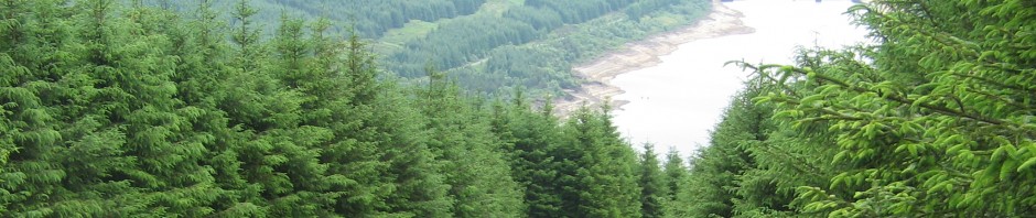
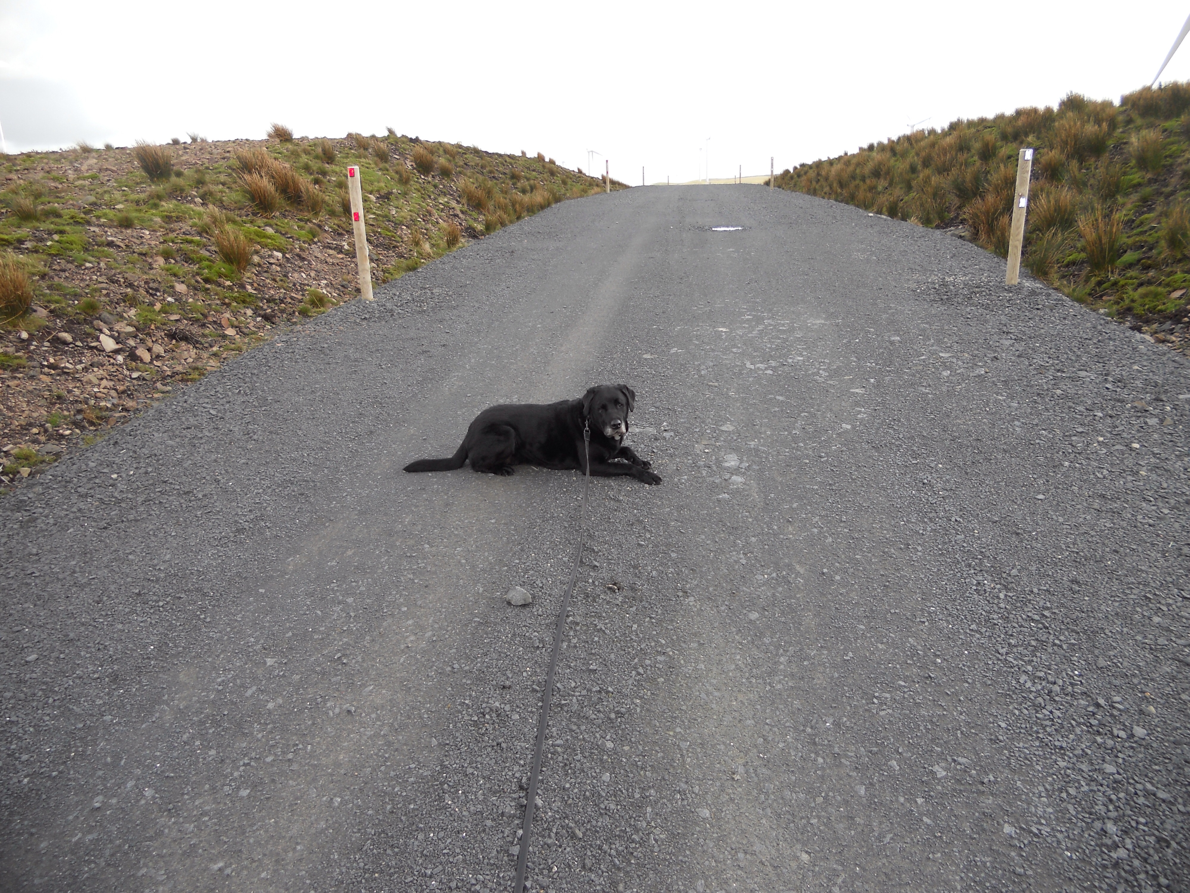
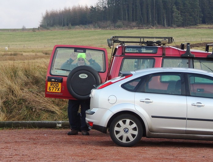
So, as Bob says, after a very successful and enjoyable SOTAEX2011 to Mull, we decided to head South this year to the Lakes for our break.  Once the plans were made and the travel Lodge in Cockermouth booked, there was no going back.  The WX on the Monday was grand for the drive down, and after ‘brunch’ in Carlisle, we had a look round Cockermouth before booking in to our digs.  The SOTAwaggon had performed well on the trip down after some remedial surgery the week before which included a new stainless steel exhaust system, and new rear springs which were probably a good idea as it was well loaded up with the usual rubbish that accompanies a road trip.  With something like 7 radios and the bits and bobs that go with them, and grub, drink, etc etc, there was just enough space to lever Patsy into the rear seat.

Tuesday dawned after a disturbed nights kip due to snoring and farting – three of us in one Travel Lodge room made for some choice aromas in the morning.  Off to Workington ASDA for breakfast, we passed some roadworks, the significance of which was lost on me at the time.  Not ’til I was home did I watch some YouTube videos of the Cumbrian floods of 2009 and realise that many main road bridges were washed away.  The works ongoing is the recovery work from a coupe of years ago.

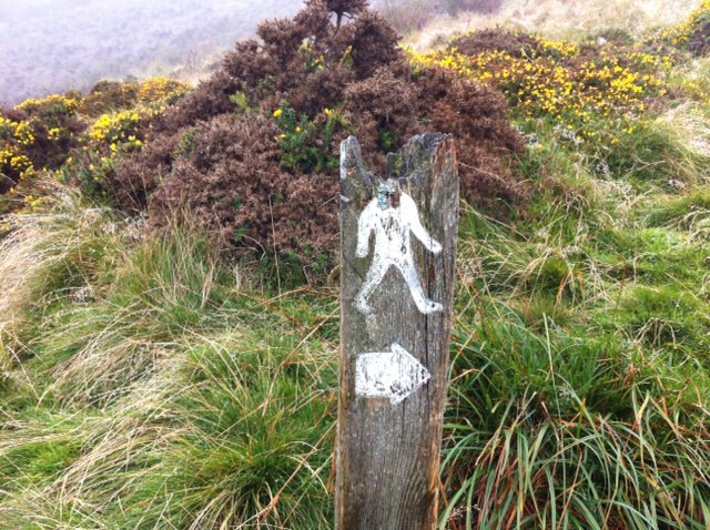
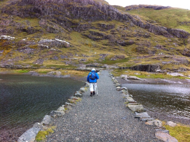
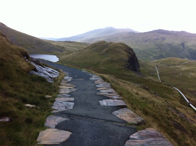
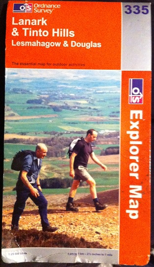
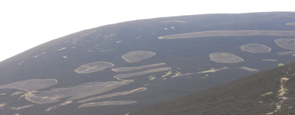
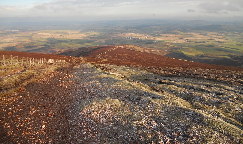
Using Ordnance Survey Explorer Map OL6 to guide us, we started up the path to Scafell Pike about 11:15 in the morning.  
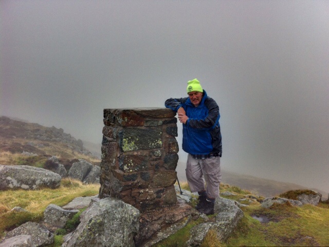
After the rain and hail showers, we arrived at the summit in 2hrs 47mins.  It was a nice walk, made more enjoyable by the couple of RAF fly-bys.  As Bob had forgotten his walking poles, he borrowed my new wooden thumb stick and he looked every inch the 50 odd year old boy scout.

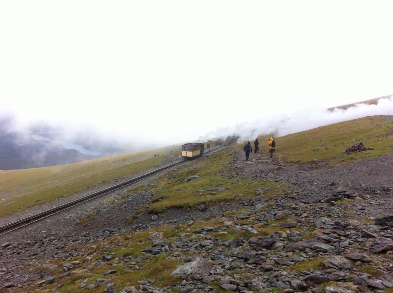
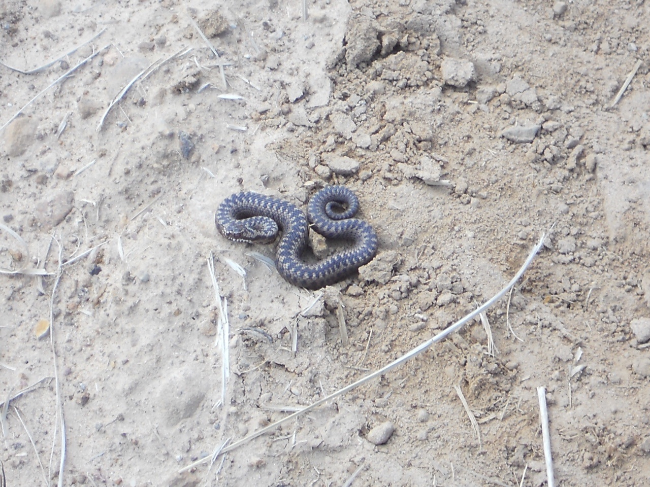
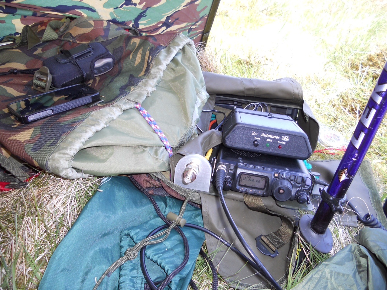
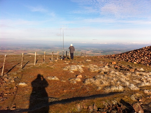
Once at the summit I took a coupe of pics then dug out the VX7 with rubber duck.   As the wind was doing its best to blow my bunnet off, it was to be a ‘handie only’ activation.  After a CQ call, the contacts came in quite rapidly on 2FM.  The chasers were :-  Patsy UPG in the car park below us keeping the motor warm and awaiting our return,  Sue OHH in Lancster, Brian ZRP in the Wirral, John TDM from Penrith, Bob ODU Lancashire, Colin UXH in Minthorp,  WHA/m was Geoff in Penrith, number 8 was Jim YLB, Peter ANX from Barrow was up next and the final contact who I worked last year from the Borders was Colin XSD from Frizington.    With 10 contacts in the soggy log, It was time to head down and into another hail shower, except this time it was now in our faces as opposed to on our backs as it had been on the way up.  Bob was beginning to wish he had worn long trousers and not long shorts, but we dried off pretty quickly with the breeze around us, and as the sun came out on the lower slopes it started to feel very pleasant indeed.  With a fast approaching shower, we made it into the shelter of the Landy just in time.  We headed home to the digs for at least two of the usual three S’s, then into town for some excellent scran courtesy of the Tithe barn.  Once refueled, it was back home to finalise the plans for the morrow, and for a kip.

Another disturbed night due to the nocturnal noises – I’m pretty sure I heard someone complain at the desk  that we were keeping an animal in the room! – and it was time for the usual morning ritual of washing, getting ready, taking radios off charge and packing ourselves into the SOTAmobile for our next days outing.  The plan for the day was to drop me at Robinson, and Bob was to be delivered to Honister pass to scale Dale Head.  This way we could both get at least two STS contacts as we were to swap hills mid way through.  Obviously before we could tackle any of that hill walking nonsense, it was off to ASDA again for the ‘Full Monty’ of breakfasts.  Patsy did his best to chat up the girl serving the scran, as he does with most females that he meets, and she took it in good spirit.  I was also most impressed with the toilets in the shop, and there was a sign informing the reader that the toilets were indeed award winning – although it would have taken a bit of cleaning by the time I was finished with it!  There goes my breakfast 😦

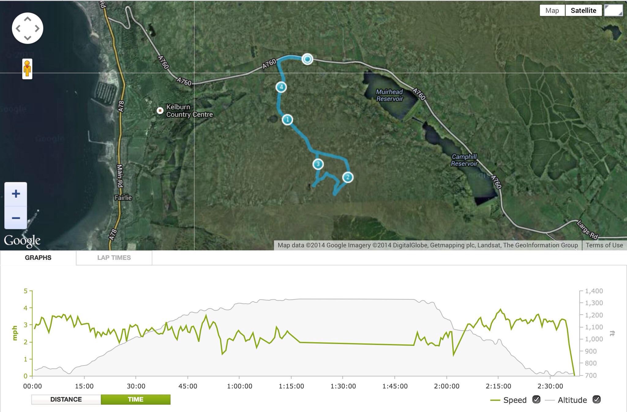
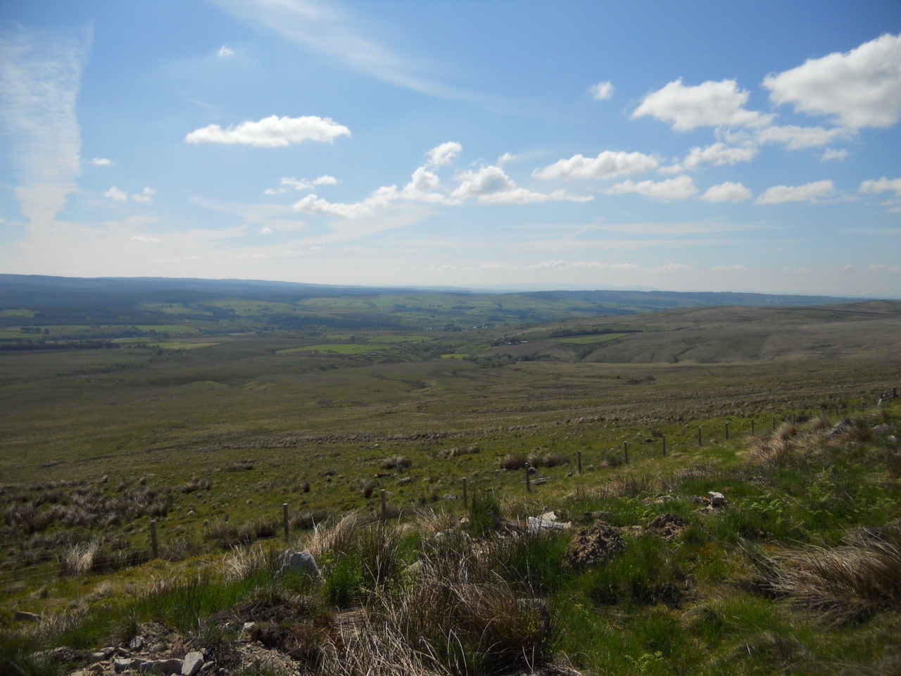
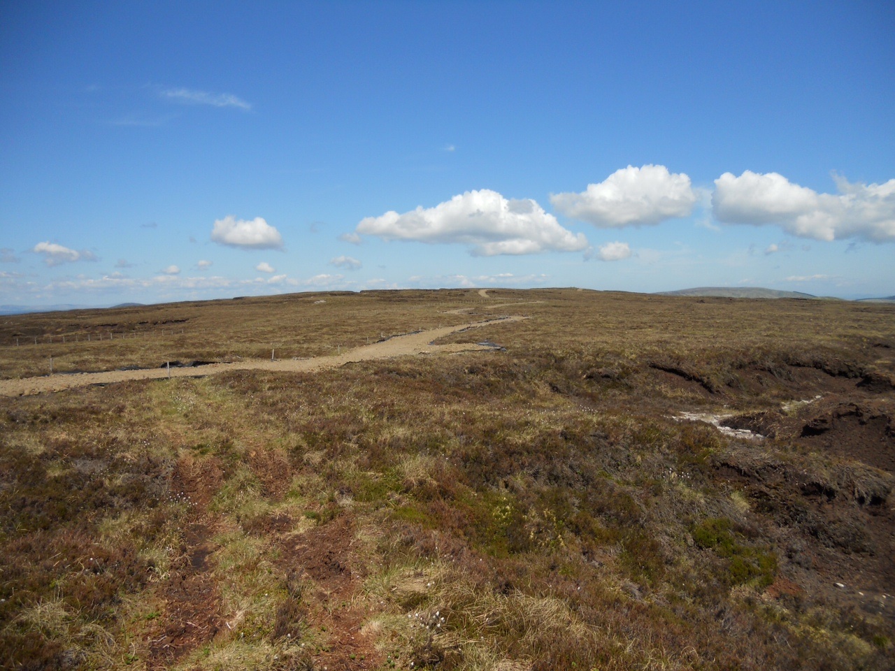
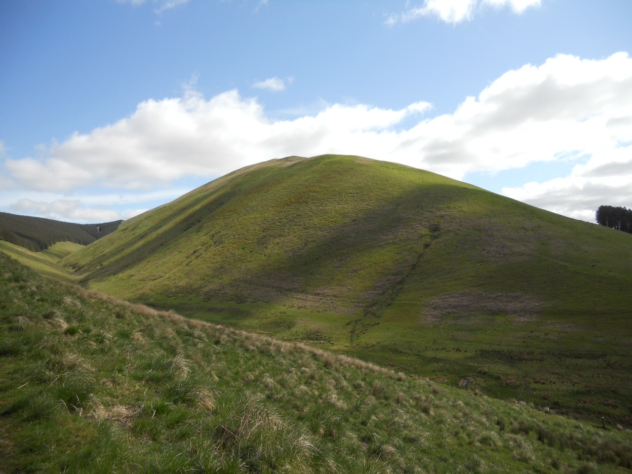
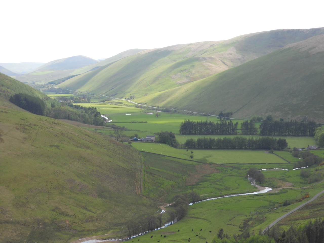
An enjoyable drive through some lovely scenery had us at Buttermere.  A quick trip up one of the many steep and winding mountain passes had us parked in the carpark at Newlands Hause at NY192176 on Ordinance Survey OL4.  The auto transmission fluid was taking a bit of a cooking due to the load on board, and the steepness of the gradients.  I unloaded my not unsubstantial frame and pack from the Landy, and set off up the faint path towards  High Snockrigg.  There is a large depresses plateau between here and the climb up Robinson, care must be taken here if you want to keep your feet dry.  It’s called Buttermere Moss, and it certainly is.  There are a couple of ‘false’ paths which lead you right into the mossy boggy middle, and I chose these paths.  I think the correct path is over to your right or South.  I never noticed this path on the ground until I was climbing the side  of Robinson and looking down on it.  This climb up the side I found quite tedious and slow going.  Maybe I wasn’t in the right frame of mind for it, as it isn’t anything too bad, although it is steep.    Anyway, I was soon at the top, arriving in about 1hr 20mins having covered 1.47 miles mostly up.

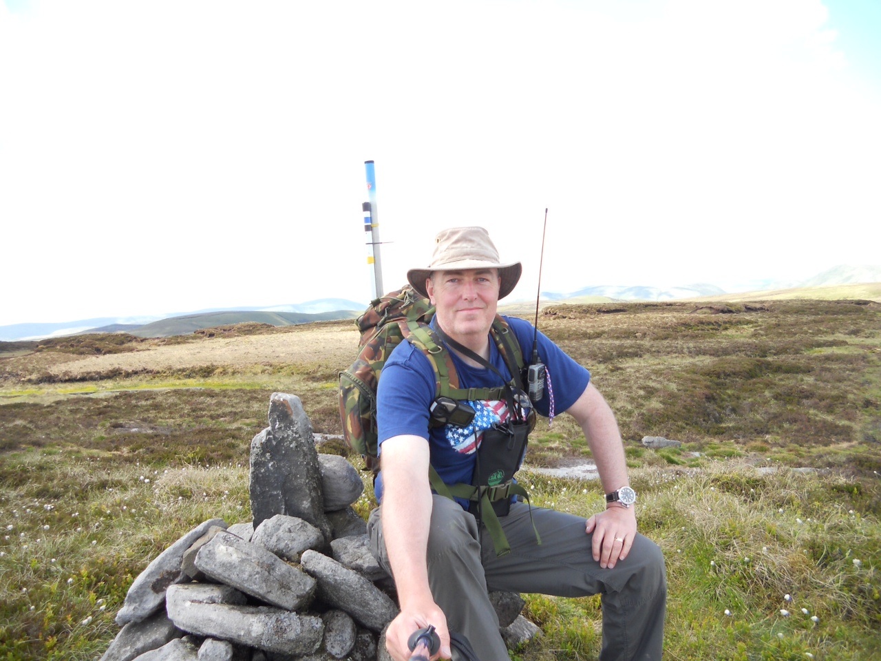
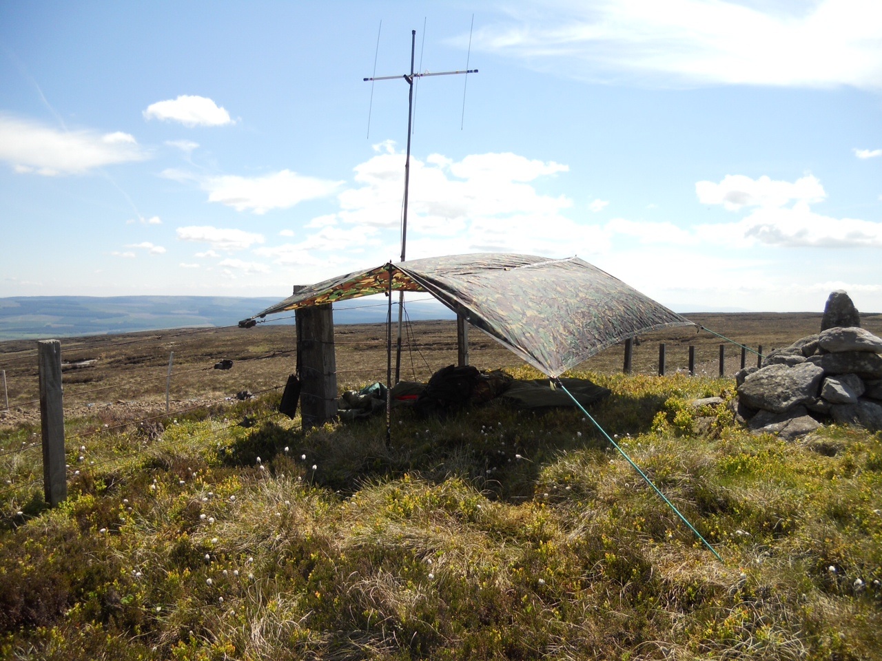
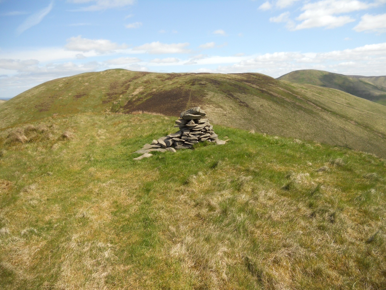
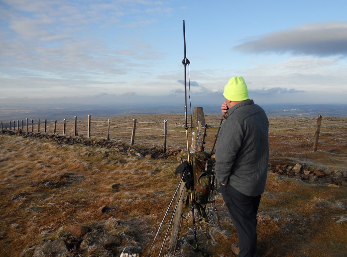
The summit structure is a stone semi circular wind break type of thing.  At first I wasn’t sure if this was the top or not, but a couple of quick checks with GAX on the radio and it was confirmed. I gabbed to a couple of fellow walkers at the top, then settled myself into the shelter to get relief from the now chilly wind.  Just using the handie, my first contact from G/LD-021 was Colin UXH.  Bobby GAX/p was next in for the official STS, then I looked over my shoulder and could see the skies darkening from the West very quickly.  There were a few chasers calling but I put out a call to say I was going QRT temporarily until the WX passed over.  I got into my Highlander bivvi bag – a present from Patsy UPG – which I had very nearly taken out of my pack in the morning before we left for the hill.  A tremendous hail shower passed through, and I could see Bobs hill Dale Head being enveloped in the nasty WX.  For the next 15 mins or so I watched waves of hail, rain and thick cloud pass by me – safe in my large green cocoon.  A slight criticism of the Highlander bivvi is that it doesn’t appear to breath very well.  It was absolutely fine for my purpose, but I think a nights kip in it night result in an uncomfortable feeling in the morning.  The radio went again and it was Sue OHH asking if I was still on frex.  Number four in the log was Geoff WHA/m with Doug KLZ not long after.  My last three were John TDM, Patsy UPG/m and finally Colin XSD from Frizington.  This gave me 9 contacts from Robinson.

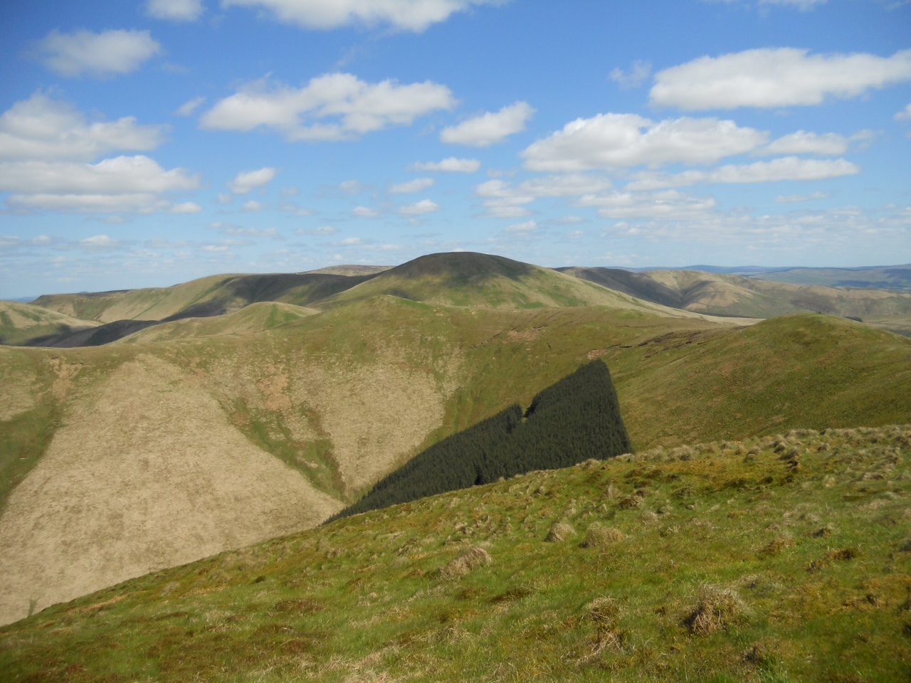
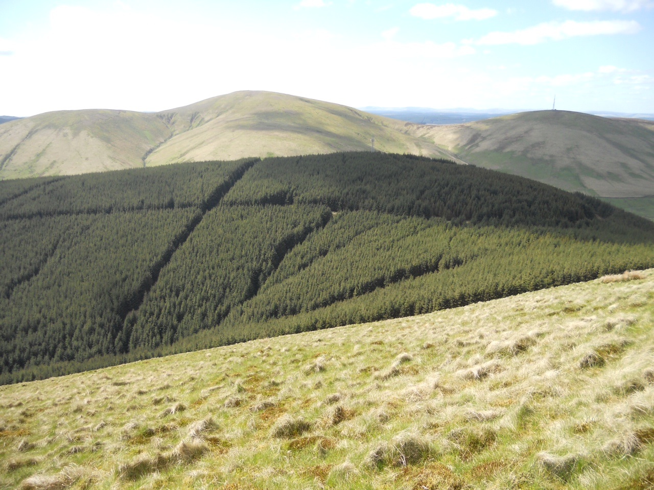
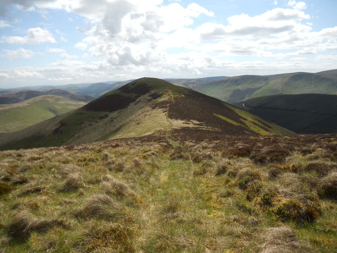
It was time to pack up and head over to Dale Head for my second activation of the day.  A quick QSO with GAX confirmed he was also about to move off from his hill.  It was fine and dry by now, but still with a touch of low cloud passing occasionally, but nothing to worry about.  Heading South East off Robinson, I was about half way up Littledale Edge when I met Bobby.  As he was wearing his luminous Greenock Morton bunnet, I actually spotted him from quite a distance.  After a gab where each of us gave the other the benefit of our observations so far, we parted and headed to our next hills.  Walking up over Hindscarth Edge, the wind was blowing strongly from the South West, coming up from Honister pass.  As I was going along using my walking poles, I nearly fell over due to the fact that my left hand pole had been blown almost horizontal, with the outcome that the point was not on the ground where it should have been, and thus when I went to put my weight on it there was just fresh air!  Yes, breezy indeed.  My attention was drawn by the beating sound of a helicopter below my to the West.  A yellow RAF cab ( probably from RAF Valley, Leconfield or Boulmer ) was making slow maneuvers and disappeared behind Fleetwith Pike.  I never spotted it again, I wonder what it was up to?

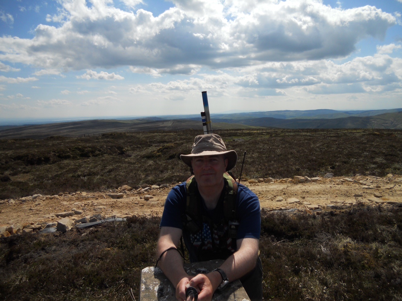
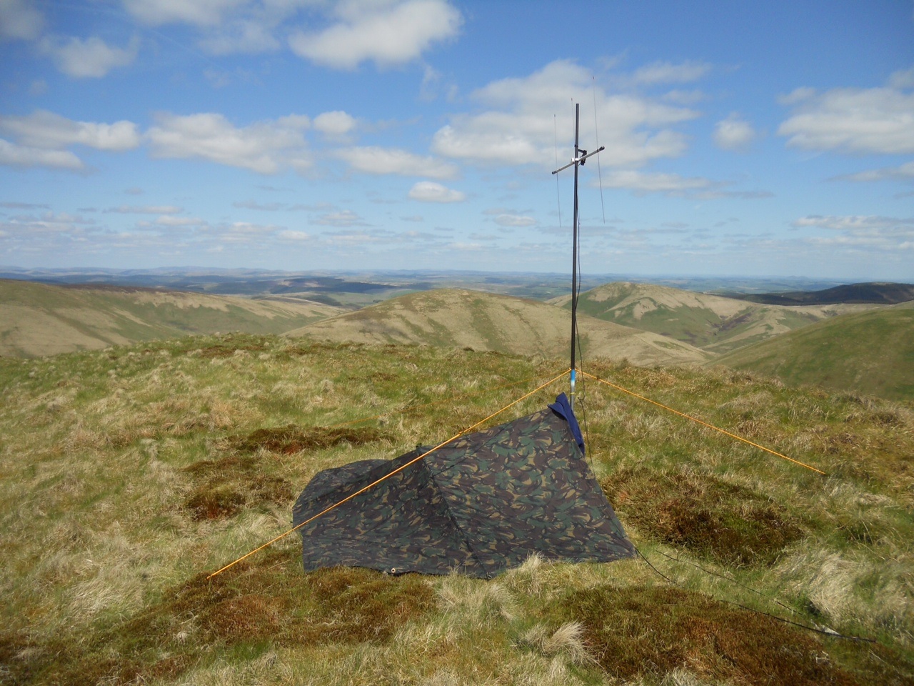
I took a few pictures on the way, but arrived the huge Dale Head summit marker after walking 1.84 miles in 1 hour 39 mins.  An old couple were sitting at the cairn and I found out they were 80 and 83 years young – and probably walking the hills faster than me.  When they left I sat with my back against the cairn on one of the more comfortable rocks and started the activation.  Colin UXH was first up, with Sue OHH second in the log.  GAX/p was next with the STS and number four was Doug KLZ.  A wee spot of rain came my way, but wasn’t anything to worry about.  Next was John TDM, Colin XSD followed him and up popped the third member of SOTAEX2012 – Patsy UPG/m in the pass below me.  My next three contacts covered England, Scotland and Wales with Geoff WHA/m, Rob LJE in Annan and my last contact was a nameless VVV/m near Halkyn mountain in Wales.

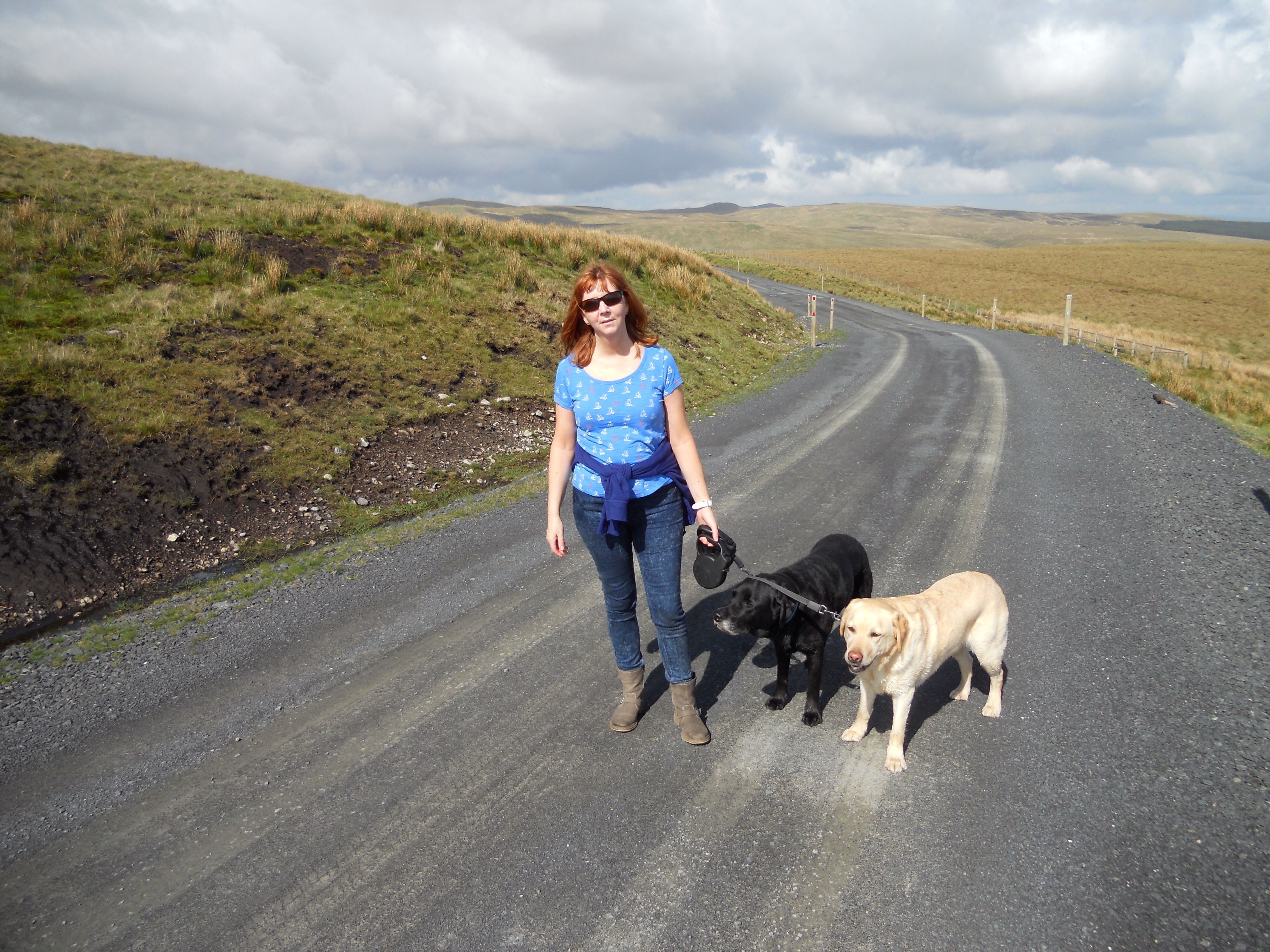
It was time to move on, with just the decent to Honister pass to tackle.  As usual, my legs suffered on the downward slope, but after 1.21 miles of ‘down’ in 42 minutes, I was at Honister Hause where Patsy was waiting.  We had a quick look round the premises and the shop, and a note was made to return the next day as the WX was to be rank.  Forgetting that Bobby was waiting to be picked up, I dawdled until Patsy reminded me that our third Musketeer was still missing.  Climbing aboard the SOTA waggon, off we set to Newlands Hause to retrieve our weary companion.  I think he was glad to see us, but he would have been a lot gladder had I not fannied about at the mine and picked him up sooner!  A cracking drive home was enjoyed, walking boots off and trainers on to relieve weary feet.  The usual evenings activities followed with showers, clean clothes and into town to the Tythe Barn for grub.  Once home, I discovered that if I hit Patsy a wallop with a spare pillow from my sofa bed, he would stop snoring for a bit.  I made a promise to myself that if he didn’t stop his noises, I would be using the pointy end of a walking pole to encourage his silence the next night.

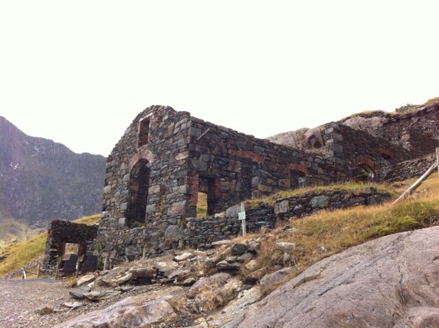
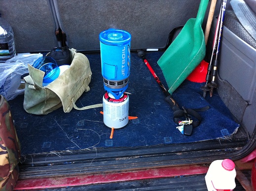
Thursday, as promised, dawned wet and dreary.  Bobby decided it was ‘a day fur the hoose’ so after the usual ASDA breakfast, Bob was dropped at ‘home’ and Patsy and I headed for Honister slate mine.  The car park was busy by the time we arrived – obviously more than just us were looking for indoor themed entertainment on such a pants day.  We arrived just in time to catch the ‘Kimberley’ tour.  The tour started with a video explaining the reasons behind why a long abandoned mine was re-opened, narrated by the late Mark Weir who owned the mine.  Then after collecting our hard hats complete with LED lamps, it was into Honisters bus and up the track to one of the older, now disused parts of the mine.  The tour leader was excellent in keeping the attention of the group, and even appointed a ‘tail end Charlie’ ( although that wasn’t the official name he gave it ) to ensure no-one was left behind. I can thoroughly recommend the tour, and the shop at Honister if you are in the area.  There are other tours available, and also an outdoors rock-face climbing type activity with a long wire bridge to cross for those a lot braver than your author.  On leaving the mine complex, we turned East and found a parking spot further down the pass.  Here, I took water from the Hause Gill and made myself some supernoodles on my old Camping Gaz stove.  They were rank, and I will never make such a pile of cr4p again.  Our onward journey took us through Seatoller, Borrowdale and up the side of Derwent water to Keswick.  We pulled in and decided that as time was not pressing, we would have a wander through the town.  Two hours parking was paid for in the waterside car park and off we set.  First thing we came across was a cracking Mercedes Ambulance belonging to Keswick MRT.  A fine looking machine, it looked very fit for purpose, being able to double as a crew carrier and take a trolley ( stretcher ).  Off into the town we wandered and had a look through the numerous out doors type shops.  I wasn’t really looking for much, just having a nosey, but in the end I bought an excellent MSR Pocket Rocket backpacking stove from one of the retailers.  No more pierced type gaz cylinders for me, this wee beauty is of the modern screw on variety, and I am very happy with it.  So, with that, we headed for the motor and then home.  After a wash and change, it was once more into the Tythe barn for our grub.  The manager directed us to our ‘usual’ table and as usual we ordered our drinks before the grub arrived.  As it was the last night, a couple more rounds were enjoyed before Patsy ( the sober one ) drove us home.  The manager had wished us well on leaving, and to be honest, if I am down that way again, I would happily give him my custom.

Friday morning saw us opening the windows and door of the room to get a through draft to try and air the room.  The smell was a bit thick, three of us in the one room, farting, burping and who knows what else.  Once we were all ready and packed up, I had to use the ‘facilities’ in the room one last time – the beer from the night before was taking its toll on my guts.  Having done my best to block the plumbing in the Travel Lodge, it was off to ASDA for, you’ve guessed it, a full monty.  We enjoyed our last grub in Workington, and I enjoyed my last visit to the award winning toilet where once again the beer was taking it’s toll on my now dicky tummy.  After fueling up the car, we headed off towards our last hill of SOTAEX2012 which was to be Stoney Cove Pike.  The drive down was excellent through Wordsworth country, and eventually to Ambleside where we turned onto the Kirkstone road, part of which is also aptly named The Struggle.  The Landy could feel it in places, even spinning a front wheel on a steeper section, and this from a 4×4.  The ATF was glad of the rest when we reached the free car park opposite the Kirkstone Inn.  I left the motor to run for a minute or two to let some fresh cool oil circulate round its steel veins.  Bobby and I readied ourselves, boots on, ruckie checked and we were off.

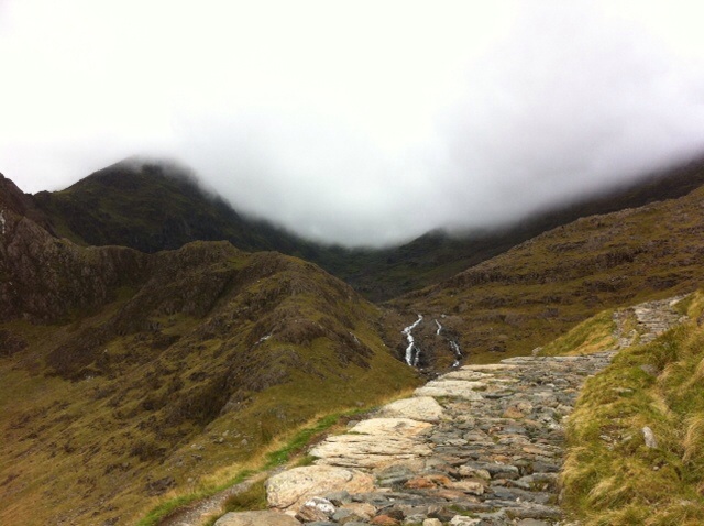
The path we were taking runs up the left side of the Inn, and is a decent enough track.  There was a wee bit of scrambling, but soon we were striding up good style, enjoying the fine weather and good walking conditions.  A few parts of the path are made from large stones placed over softer ground like big stepping stones, and they were a great help.  A couple of brief stops to take pictures and for me to phone my wife at work, and soon we were nearing the top.  We heard a station on top of Snowdon calling on S20, so as we were within the activation zone, a good STS was there for the taking.  I handed Bobby my VX7 to let him make the first contact while I logged.  I was next up on the radio, and called our Welsh counterpart – silence.  I called a few times, as did other stations but nothing came back.  So Bobby got 10 chaser points, and I got nowt for being a gentleman and letting him go first!  Within a couple of minutes we were on the summit of Stoney Cove Pike enjoying the view from the summit cairn.    Bobby got his 4M stuff out, and as usual I went onto 2FM with just the VX7 with rubber duck and my 2.5 watts.  The calls came in pretty quickly and started off with OHH Sue, UXH Colin, KLZ Doug and my number four to qualify the hill was ZRP Brian.  Quickly following them with little delay were ODU Bob, WHA/m Geoff, TDM John, SJJ was Sam in Barrow, XYL Karen who I struggled with a bit, UPG/m Patsy keeping the get away car warm in the Inn car park, then a brace of Johns – GUX and BLV and my last contact of the hill, day and holiday was a STS with Richard JTD who was on G/LDW-023 and was just starting his short break as we were finishing ours.

With the contacts now dried up, it was time for a couple of photos and then off.  As is quite common, Bob and I descend at different rates – one or other of us is stopping for pictures or a pee or something, and so it was this time too.  We could see a large squall heading towards us, so on the final part of the downward leg, haste was made to toward the shelter of the SOTAwaggon.  After changing out my boots and dumping my rucksack in the motor, we headed over to the Kirkstone pass Inn for a refreshment before the long (158 miles) journey home.  We ordered our drinks, and for the last time on English soil, I headed to the loo and done what bears do.  If this tale teaches the reader any sort of lesson, it should be not to consume alcohol the night before a SOTA activation.  Once our drinks were finished, we bade farewell to the lovely barkeep and shortly we were following the Garmins female voice back over the border.  The drive home was excellent with clear skies and quiet roads.  We only stopped briefly to stretch our legs, me especially as the weeks outings had taken its toll on my left knee, and as I write this nearly three weeks later, my knee is still dodgy.  Anyway, once at Tesco in Port Glasgow we squared up the fuel bill, phoned or loved ones to warn them of our imminent arrivals and I dropped Bobby and Patsy at their respective home QTHs.

All in all, an excellent and very enjoyable five days away with a couple of firsts for me.  My first 10 point hill and my first double activation.   The WX while not hot and sunny had been kind, the company excellent and even Patsy avoided being suffocated while he lay snoring his head off on the sofa bed in the digs.  One thing I did notice was that Patsy didn’t snore while he slept sitting upright in the back of the motor – he slept a lot during our journey – so, I have come up with a cunning plan.  For SOTAEX2013 Patsy will not be getting a bed in our chosen accommodation, he will instead be lashed to a chair where he will sleep quietly and the rest of mankind can enjoy a good nights kip!

Posted in Uncategorized | Tagged | 2 Comments

Larriston Fell GM/SS-161 19 Aug 12

OK, here’s the story.  Back down in the Borders for a couple of weeks, so I have to do at least one SOTA activation.  Last year it was Blackwood hill, so something different this year.  Having looked at the map and the SOTA database, I decided on Larriston Fell.  First it looked easy enough, secondly after researching it I was intrigued by the mention of a mysterious carpark at the top of the forest track, and third it wouldn’t be much of a detour to visit another place that took my fancy – Bloody Bush – the old Border crossing between our Fair Nation and G land.

A couple of different maps can be used here – O/S explorers 324 and OL42  – as both have the desired track on them.  During my research most of the info was on a South to North climbing of the hill, but I didn’t fancy driving round to Kielder to park the car and start there.  Only one mention of an ascent from this side, and the person that wrote it suggested parking your car at the entrance to the track you will be walking, but this also leads up to a house on the track.  I am a bit of a stickler for doing these things properly, so off I set the day before to find somewhere to abandon the SOTA waggon so it wouldn’t be in anyones way.  The best, actually the ONLY parking spot was to be found about a half mile walk from the beginning of the track I would tackle where two cars can fit into the lay-by.

So, Saturday arrived and my alarm went off at half seven.  I could just about hear the alarm over the noise of the rain drumming on the roof of the caravan, so it was quickly switched off and all thoughts of an early start soon disappeared as I drifted once more into the land of nod.  Saturday afternoon turned out to be a cracker, so the day wasn’t wasted and the dogs enjoyed a good few miles on a forest track.  I checked the WX for the morning.  Sunday promised a good start with rain moving in later in the afternoon.

Sunday dawned bright with blue skies and very warm.  I didn’t need to wait on my alarm getting me up, the sound of a heaving dog just about to be sick was the noise that welcomed me into the Sabbath.  After cleaning up the mess, my good Lady wife reminded me that it was all MY fault this had happened as I had let him eat a big sheep pooh the day before – well he is a Labrador, and I didn’t exactly force it down his neck!!  Once I had breakfasted and taken the dogs for a walk – avoiding all sheep shit this time, I was soon into the SOTA-mobile and on my way.  My pack having been sorted on the Friday evening, all I had to do was get my chits out the fridge and stick them in.  No Tesco petrol station around these parts to stock up on scran.  It was a short drive of a few miles to NY53558 92716 where the motor was abandoned for the rest of the day.  Ten minutes walking along the ‘main’ road admiring the scenery had me at the start of the track at NY52914 92142.  The gate has welcoming sign on it – PRIVATE ROAD – but as it is a forestry track also, I assumed this applies to motorized traffic only.  Another ten minutes up this track and you are passing Mountain View which is a lovely looking cottage with a small stable etc – the kind of place we would all love to own.  Just after this the forest thins out for a good bit and you are either walking in open space, or with the forest just on one side of you.  Not a great deal to report on on this leg of the walk, just a constant up.  Loads of very smart looking spider webs heavy with morning dew glistening in the sun, the odd deer could be heard in the forest and an occasional cry from a large bird were my companions on this part.  As mentioned, plenty of going up.  Do not deviate from the main path you are on, just keep going and you will leave the forest and arrive shortly thereafter at the mysterious car park on the hill.  It took me  about 1 hour 20 mins to cover the 3.44 miles to this point.  As mentioned in a previous posting, I use Endomondo on my phone to log my walking, it is very accurate and is always to hand.

The car park is like a large concrete oval on the top of the hill.  It has been suggested it was used by the RAF, but I can’t find anything concrete (groan!) to support this.  There are about 6 or 8 posts that look like cut off lamp posts which have heavy duty power points on them.  I don’t know if they were used to supply vehicles that were parked up there, or maybe they were used to supply the near by radio tower from portable generators that might have been parked up before a mains supply was installed?  Answers on a post card please if you can shed light on this.  I didn’t look to see if the power points were male or female which might have provided a clue.  Anyway, I’m off on one of my famous tangents.  I stopped at this car park for something to eat and drink as I had pressed on pretty much without stopping since I got out the car.  The midges were feasting on me too, but occasionally the breeze would pick up and offer welcome relief from them.  Still just in a t-shirt, I had long trousers on for the first time this holiday as the reports had mentioned knee deep heather on the last push.  Rummaging in my ruckie, I found my midge net which not only kept the wee buggers away, also acted as a kind of ‘kidnap’ hood and obscured my view of the way to go.

Once the flying pests had had their fill of me, I set off across the heather along an imaginary track shown on the O/S map.  I crossed one low non barbed wire fence and headed to a high point.  I was about half way to the trig. The heather had sphagnum moss to keep it company so watch where you step or you might end up with wet feet.  It took about half an hour to cross the moor to the trig.  Once there, the breeze stayed reasonably constant so I could dispense with my netted headgear.

The radio of choice for this outing was the FT817, coupled to a 3 ele ‘SOTA’ beam.  Mounted on a short roach pole, the beam was about 8 feet off the ground.  Coupled to my 512 meters ASL, I had not too bad a takeoff.  Most of the surrounding terrain is a similar height so I wasn’t stuck immediately behind a big hill.  A text alert from fellow activator and PARC club member Bobby GAX informed me Mr SOTA Robin PKT was about.  I found him on his usual haunt of 145.400 and waited for him to finish his QSO.  There was a bit of QSB, but signal reports of 5/1 were exchanged, not too shabby for a distance somewhere in the region of 216km or 134 miles!  Happy to have my first STS in the bag, I QSY’d to .425 to try and get GAX.  QSB allowing, we were 5/1 which was good as Bobby was not on the highest of hills in his area.  Whilst not a SOTA STS, I was glad to get the contact with him as he had made the effort to head out to a high point and chase me.  With signals fading, we bade each other 73 and I gave a few calls on S20.  I could hear Robert 2M0IZC near Glasgow airport very clearly, but my efforts to contact him were thwarted.  The next to come back to my call was Jim GM3JSX in Gretna.  With a full scale signal, we had a short QSO then back on the hunt for my #4 to qualify the hill.  Quickly I got 2E0MLY/m who was heading North on the M6 in his motor home.  Next up was Peter G8RZ who was working lighthouses on the air with the other call sign of GB4WIL.  Peter was on Walney Island in the club caravan for the weekend with others from his club activating the lighthouse.

I stopped for some scran, so I demolished the sandwiches lovingly prepared for me by my XYL – before she found out I had knocked the dog ill – and a bottle of Scotland’s finest IrnBru.  There was a drop in the temperature and I could definitely see a grey mass approaching from the South West.  Time for one last call before I packed the 817 safely out of harms way.  Pointing North, I immediately had GM1TPO/m coming back to me.   Rob was out walking in the Border hills with his XYL.  We had an enjoyable QSO before we both decided it was time to leave our respective hills.  With the prospect of the rain moving in as forecast, I packed up the 817 and then wrapped it in my bivvi bag as an extra measure.  Once all ready to go, I heard a /p station on the VX7 handie.  This was 2E0RWB/p.  Ron was on the summit of G/LD-007 Fairfield.  He had trouble logging my contact due to the heavy rain and was about to go QRT.  This rubber stamped my idea to pack up and off I set.

Once back across the ‘moor’ at the radio mast, I decided that I would chance getting wet and head in the opposite direction to visit Bloody Bush.  Still t-shirt clad, I set off at a decent pace and soon came to the border crossing.  It was amazing to think that what was now ‘in the middle of nowhere’ was once a main road and a principal crossing between Scotland and England.  The very impressive stone pillar looks as good today as I’m sure it would have done when it was first built.  No crap aluminum sign here, they knew how to make road signs back in the day.  I amused myself with walking back and forward between Scotland and England for longer than was necessary, but as the rain was coming on, and it was time to head for home.  I put on my trusty old North Face fleece which has been up many a mountain – not the best fitting or most stylish of garments, but it is an old friend of mine – and I set off back up the track to the car park in the sky before descending to my car parked in the valley below.  The rain never progressed past the light shower stage and after 2 hours 3 minutes and 5.78 miles since leaving the summit I was back at the SOTA waggon which was waiting to shelter me from the rain.

Total milage for the day was 9.92,  walking time was 3 hours 56 minutes and I managed a measly 7 contacts.  An excellently enjoyable day, more contacts would have been good, but I had enough for the log.  This is a grand walk and if ever the chance to be dropped off at the Newcastleton end and picked up again at the Keilder end presented itself, I would recommend it to anyone – well maybe not to my 80 year old parents but you get the idea.

So, onto my doggy forecast.  Most of the time you are walking on a forest track which is shared with a cycle route, but I only came across 6 cyclists all day.  So, if you are happy with this, then why not.  The only time the dogs might need a hand is crossing the open moor with deep heather, but dogs being what they are I imagine all but the shortest legged of our hairy friends should manage to make their way across to the trig point.  No sheep were encountered, but this is not to say they will never be there so an extendable lead or excellent close control of your pooch would be a help at times.

Posted in Uncategorized | 5 Comments